1.3K
Mountain Peaks in Alexander County
| Mountain Peak/Hill | Elevation [Meter] |
|---|---|
| Burner Hill | 179 |
| Dogtooth Bend Mounds | 99 |
| Gilson Hills | 142 |
| Italian Hill | 196 |
| Rattlesnake Hill | 139 |
| Santa Fe Hills | 177 |
| Vick Hill | 233 |
More Maps of Alexander County
Airports in Alexander County
| Airport Name |
|---|
| Cairo Regional Airport |
| Hunter Raffety Elevators Inc Airport |
| Tamms Correctional Center Heliport |
| Village of Tamms Heliport |
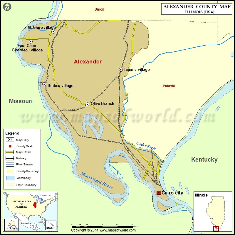
Cities in Alexander County
| City | Population | Latitude | Longitude |
|---|---|---|---|
| Cairo city | 2831 | 37.006124 | -89.18197 |
| East Cape Girardeau village | 385 | 37.295732 | -89.48691 |
| McClure village | 402 | 37.314708 | -89.433166 |
| Olive Branch | 864 | 37.175469 | -89.351746 |
| Tamms village | 632 | 37.241542 | -89.271329 |
| Thebes village | 436 | 37.213976 | -89.454383 |
 Wall Maps