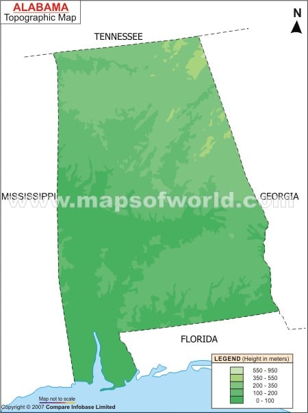
The Piedmont Plateau of the east- central part of the state is characterized by high mountain ranges and valleys. The highest point of Alabama, the Cheaha Mountain is situated in the northern part of the Piedmont Plateau.
The Cheaha Mountain is placed at an altitude of 2,405 feet. Shades, Red, Lookout, part of Appalachian hills and Oak are the notable mountain ranges of the area. The Appalachian Plateau is situated in the northwestern part of the state of Alabama. The Coastal Plain of Alabama is located in the southern part of the state. The Coastal Plain comprise of fertile lowlands that are suitable for growing cotton.
Guntersville Lake is the biggest lake of Alabama. Several rivers flow through the state of Alabama. Alabama, Tombigbee, Tallapoosa, Conecuh, Black Warrior, Tennessee, Tombigbee, Pea, Cahaba and Choctawatchee are the prominent rivers of the state. Among this the Tennessee, Alabama and Tombigee River are the longest rivers of Alabama. The Alabama State Map provides comprehensive information about the heterogeneous topography of the state.
