- National Park Maps of Neighbouring States - Tennessee National Parks, Georgia National Parks, Mississippi National Parks, Florida National Parks
- US National Parks Map
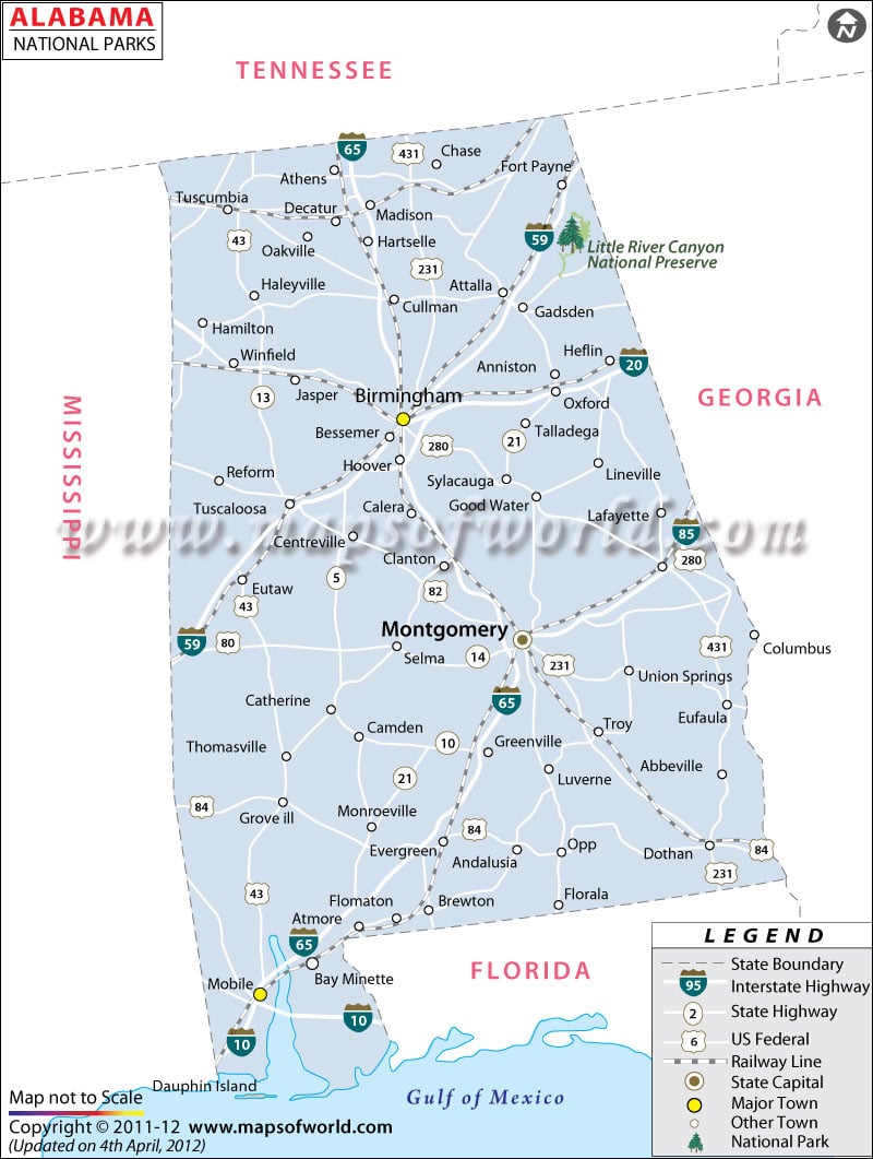
The Alabama State National Parks Map points out the exact location of the several National Parks of the state. Little River Canyon National Preserve, Tuskegee Institute National Historic Site, Russell Cave National Monument, Horseshoe Bend National Military Park, Natchez Trace Parkway, Trail Of Tears National Historic Trail, Tuskegee Airmen National Historic Site, and Selma To Montgomery National Historic Trail are the prominent National Parks of Alabama.
The Tuskegee Airmen National Historic Site presents the tourists to explore the rich military history of the state of Alabama. The Alabama State Map serves as a useful guide to find out the important cities that have the famous National Parks of the state.
How many National Parks are in Alabama?
Alabama in total has nine National parks that depict the state’s rich history with scenic natural landscapes. The parks in Alabama state have a lot to offer from exciting excursions, breathtaking sights, and eye-opening learning experiences. The National Parks in Alabama are:
- Horseshoe Bend National Military Park
- Little River Canyon National Preserve
- Muscle Shoals National Heritage Area
- Natchez Trace National Heritage Area
- Russell Cave National Monument
- Selma to Montgomery National Historic Trail
- Trail of Tear National Historic Trail
- Tuskegee Airmen National Historic Site
- Birmingham Civil Rights National Monument
List of National Parks in Alabama |
|---|
| S. No | Name | Area | Established | Location |
|---|---|---|---|---|
| 1 | Little River Canyon National Preserve | 13,633 acres (55.17 km2) | Oct 24, 1992 | Cherokee County & DeKalb County, Alabama, USA |
Best National Parks in Alabama
-
Little River Canyon National Preserve :
Little River is unique because it flows for most of its length atop Lookout Mountain in northeast Alabama. Natural resources and cultural heritage come together to tell the story of this preserve. This park offers the tourist a wonderful opportunity to enjoy the natural splendor. Forested uplands, waterfalls, canyon rims and bluffs, pools, boulders, and sandstone cliffs offer settings for a variety of recreational activities.
-
Horseshoe Bend National Military Park:
The park is spread over 2040 acres. The park is the site of the last battle of the Creek War on March 27, 1814. General Andrew Jackson’s Tennessee militia won a decisive victory against the Upper Creek Red Stick Nation during the Battle of Horseshoe Bend at this site on the Tallapoosa River. When you visit, start at the Park’s Visitor Center and learn about the role of the battle.
-
Russell Cave National Monument:
This site offers visitors a unique scope to explore the rich archeological heritage of the state. The park has many records of prehistoric cultures in the southeast. The Native American Festival of the Russel Cave displays the Unique lifestyle of the indigenous inhabitants of the place.
-
Natchez Trace Parkway:
The park covers a total area of 444 miles. It roughly follows the ”Old Natchez Trace” a historic travel corridor used by American Indians, European settlers, soldiers, and future Presidents. Today, people can enjoy not only a scenic drive but also hiking, biking, horseback riding, and camping along the parkway. This park provides the tourist with an exciting tour of the southern part of the Mississippi River.
Best time to visit National Parks in Alabama
The National parks in Alabama are operational in all four distinct seasons. Summer is the busiest season, offering visitors hot, humid days, afternoon storms, and cooler evenings. However, if whitewater Kayaking is on your itinerary, we suggest going to Little River in the winter. During this time the water level is up, and experienced whitewater Kayakers can have their run of the water.
