logo


Colombia Latitude and Longitude Map

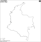
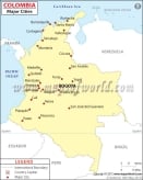
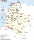
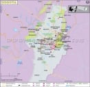
Colombia's latitude and longitude is 04° 00' N and 72° 00' W . Below is the map of Colombia showing major towns, roads, airports with latitudes and longitudes plotted on it.
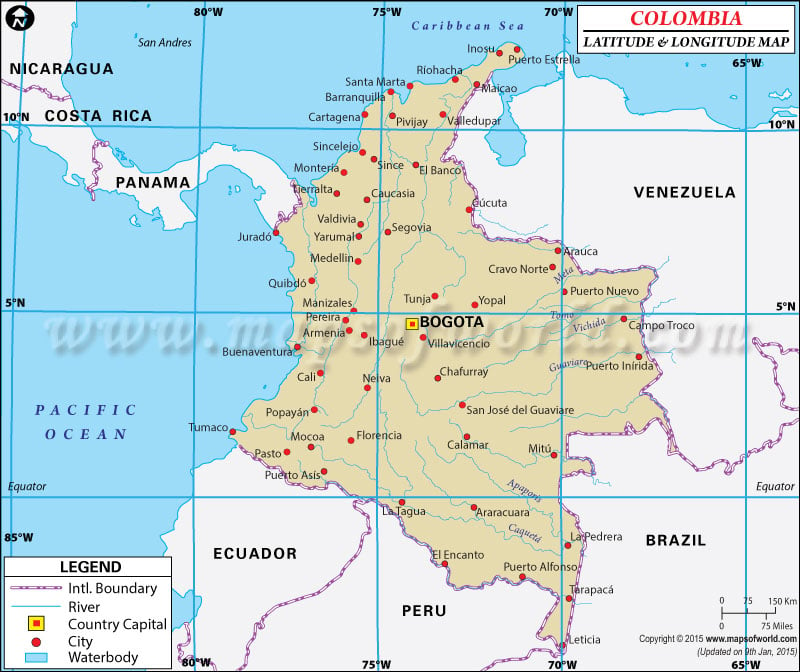
Colombia Latitude and Longitude Map Nicaragua Lat Long Costa Rica Lat Long Panama Lat Long Venezuela Lat Long Ecuador Lat Long Brazil Lat Long Peru Lat Long Ecuador Lat Long
Description : Find Colombia latitude and longitude map showing comprehensive details including cities, roads, towns, airports and much more. Disclaimer
×

Disclaimer  :  All efforts have been made to make this image accurate. However MapSherpa, Inc, its directors and employees do not own any responsibility for the correctness or authenticity of the same.


Search For Latitude & Longitude Map

By Country

Or

Latitude

Longitude

Or

Area

* Put South & West values with minus ( - ) sign.


Colombia is located within the latitude and longitude of 04° 00 N, 72 º 00 W.

Colombia is situated on the northwestern corner of South America. Colombia covers both the northern as well as the southern hemispheres. The capital city of Colombia is Bogota. The latitude and longitude of Bogota, the capital city of Colombia is the 04º 38' N, 74º 05' W.

The climate within this latitude and longitude of Colombia has some remarkable variations. In general terms, weather conditions are hot and humid along the coastal areas.

The hottest months are March and April whereas; the coldest months are July and August. Within 04º 38' N and 74º 05' W latitude and longitude of Bogota, Colombia, the average summer temperatures rise up to 78° F. A large amount rainfall occurs from the month of March to May and from September to November.

Latitude and Longitude of Colombia

LocationLatitudeLongitude
Aguja, C. de la11°18'N74°12'W
Antioquia06°40'N75°55'W
Apaporis01°23'S69°25'W
Arauca07°00'N70°40'W
Arica02°00'S71°50'W
Arjona10°14'N75°22'W
Armenia04°35'N75°45'W
Barbosa05°57'N73°37'W
Barrancabermeja07°00'N73°50'W
Barranquilla11°00'N74°50'W
Bello06°20'N75°.33'W
Bogota04°34'N74°00'W
Bucaramanga07°00'N73°00'W
Buenaventura03°53'N77°04'W
Buga04°00'N76°15'W
Caguan00°08'S74°18'W
Calamar10°15'N74°55'W
Cali03°25'N76°35'W
Caqueta01°15'S69°15'W
Carmen09°43'N75°08'W
Cartagena10°25'N75°33'W
Cartago04°45'N75°55'W
Cauca08°54'N74°28'W
Central, Cordillera05°00'N75°00'W
Charambira, Punta04°16'N77°32'W
Chiquinquira05°37'N73°50'W
Cienaga11°01'N74°15'W
Corrientes, C.05°30'N77°34'W
Cucuta07°54'N72°31'W
Cupica, G. de06°25'N77°30'W
Darien, G. del 09°00'N77°00'W
El Diviso01°22'N78°14'W
Florencia01°36'N75°36'W
Fundacion10°31'N74°11'W
Fusagasuga04°21'N74°22'W
Gallinas, Pta12°28'N71°40'W
Garzon02°10'N75°40'W
Gorgona, I.03°00'N78°10'W
Guainia02°01'N67°07'W
Guajira, Pen. da la12°00'N72°00'W
Guaviare04°03'N67°44'W
Huila, Nevado del03°00'N76°00'W
Ibague04°20'N75°20'W
Inirida03°55'N67°52'W
Ipiales00°50'N77°37'W
 
LocationLatitudeLongitude
La Pedrera01°18'S69°43'W
La Tagua00°03'N74°40'W
Leticia04°09'S70°00'W
Magangue09°14'N74°45'W
Magdalena 11°06'N74°51'W
Malpelo I. De04°03'N81°35'W
Manizales05°05'N75°32'W
Medellin06°15'N75°35'W
Mitu 01°15'N70°13'W
Mococa01°07'N76°35'W
Mompos09°14'N74°26'W
Monteria08°46'N75°53'W
Morrosquillo, G. de.09°35'N75°40'W
Mosquera02°35'N78°24'W
Neiva02°56'N75°18'W
Occidental Cordillera05°0'N76°0'W
Oriental Cordillera06°0'N73°0'W
Orocue04°48'N71°20'W
Pamplona07°23'N72°39'W
Pasto01°13'N77°17'W
Patia02°13'N78°40'W
Pereira04°49'N75°43'W
Perija Sierra de09°30'N73°03'W
Popayan 02°27'N76°36'W
Providencia I. De 13°25'N81°26'W
Puerto Carreno 06°12'N67°22'W
Puerto Inirida03°53'N67°52'W
Puerto Leguizamo0°12'S74°46'W
Puerto Limon03°23'N73°30'W
Puerto Wilches07°21'N73°54'W
Purace Vol.02°21'N76°23'W
Quibdo05°42'N76°40'W
Riohacha11°33'N72°55'W
Riosucio7°27'N77°7'W
Roncador Cayos13°32'N80°4'W
Santa Marta11°15'N74°13'W
Tolima4°40'N75°19'W
Tomo 5°20'N67°48'W
Tulua4°6'N76°11'W
Tumaco1°50'N78°45'W
Tunja5°33'N73°25'W
Vichada4°55'N67°50'W
Villavicencio4°9'N73°37'W
yari0°20'S72°20'W
Yarumai6°58'N75°24'W

Last Updated on: November 10th, 2017