logo


Andorra Latitude and Longitude Map

Andorra's latitude and longitude is 42° 00'N and 1° 30' E . Below is the map of Andorra showing major towns, roads, airports with latitudes and longitudes plotted on it.
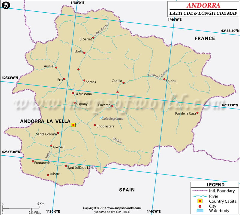
Andorra Latitude and Longitude Map Spain lat long map France lat long map
Description : Find Andorra latitude and longitude map showing comprehensive details including cities, roads, towns, airports and much more. Disclaimer
×

Disclaimer  :  All efforts have been made to make this image accurate. However MapSherpa, Inc, its directors and employees do not own any responsibility for the correctness or authenticity of the same.


Search For Latitude & Longitude Map

By Country

Or

Latitude

Longitude

Or

Area

* Put South & West values with minus ( - ) sign.


The latitude and longitude of Andorra is 42ºN and 1º 30' E respectively. It is located in southwestern Europe and lies between France and Spain.

The total area is 2°5 times than that of Washington DC. The capital city of Andorra la Vella lies in 42º 30' N and 1º 30' E latitude and longitude respectively. Andorra has 7 parishes and is 6 hours ahead of Washington DC during Standard Time.

The climate of Andorra is mostly that of a temperate type. The winters are snowy and cold while summers are dry and warm. The terrain is mostly mountainous dissected by narrow valleys. Andorra is a completely land-locked area with no coastlines, however, there are many important crossroads in the Pyrenees. The total area is 468 square kilometers. Deforestation, overgrazing and air pollution are the major environmental concerns of Andorra. Avalanches and mountain slides are quite common in the region.

Locations Latitude Longitude
Andorra La Vella42°31'N01°32'E

Last Updated on: November 7th, 2017