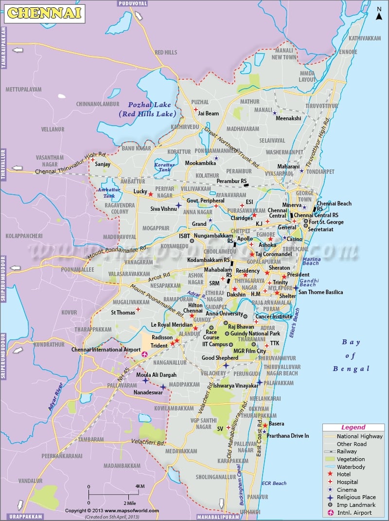
18.1K
Facts About Chennai |
|
|---|---|
| Country | India |
| Former Name | Madras |
| Latitude and Longitude | 13.0810° N, 80.2740° E |
| Population | 11,503,293 (2022) |
| Area | 69.91 sq miles (181.1 km²) |
| Languages | Tamil, English, Hindi, Urdu, Malayalam |
| Time Zone | IST (UTC+05:30) |
| Postal Codes | 600 xxx |
| Area Code | +91(India) 44(Chennai) |
| Major Airport Names of Chennai | (MAA) Chennai Airport, Anna International Airport |
| Points of interest | Marina Beach, St Thomas Mount, Kapaleeshwarar Temple, M. A. Chidambaram Stadium, Fort St. George, Guindy National Park, Valluvar Kottam, Birla Planetarium |
| Demonym | Chennaite |
previous post
