logo


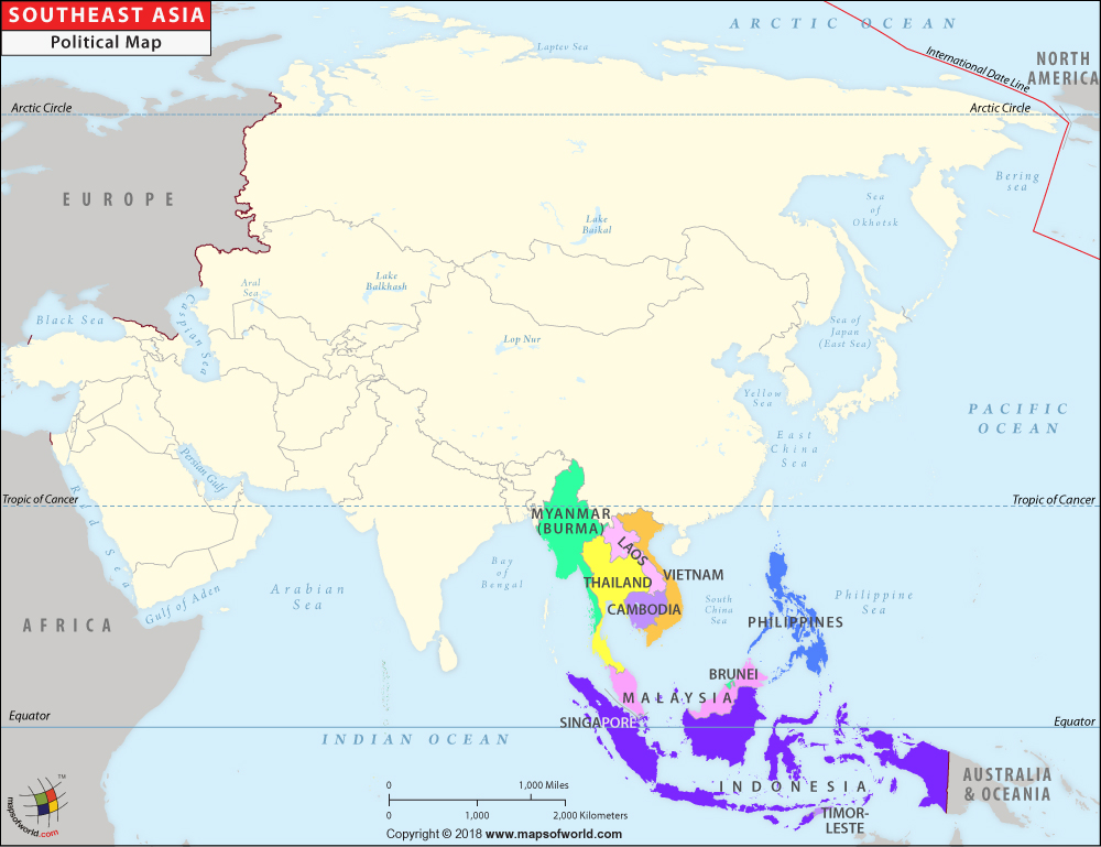
Southeast Asia Map

Southeast Asia Map Myanmar (Burma) Thailand Laos Cambodia Vietnam Indonesia Timor-leste Malaysia Brunei Philippines
Description : The Southeast Asia Political Map depicts the countries that are situated in the region. Disclaimer
×

Disclaimer  :  All efforts have been made to make this image accurate. However MapSherpa, Inc, its directors and employees do not own any responsibility for the correctness or authenticity of the same.


Southeast Asian Countries : Area, Population and Capitals
StateArea (km2)Population (2016)Capital
Indonesia1,904,569 258,802,000 Jakarta
Philippines342,353 102,904,637 Manila
Vietnam331,210 92,637,200 Hanoi
Thailand513,120 68,981,000 Bangkok
Myanmar676,000 52,254,000 Nay Pyi Daw
Malaysia329,847 30,751,602 Kuala Lumpur
Cambodia181,035 15,776,000 Phnom Penh
Laos236,800 7,163,000 Vientiane
Singapore724 5,591,000 Singapore (city-state)
East Timor14,874 1,188,000 Dili
Brunei5,765 423,000 Bandar Seri Begawan
* Data from various Sources


Regions of Asia
East Asia MapWest Asia MapSouth Asia MapCentral Asia Map
Southeast Asia Map   

Last Updated on: July 27,2020