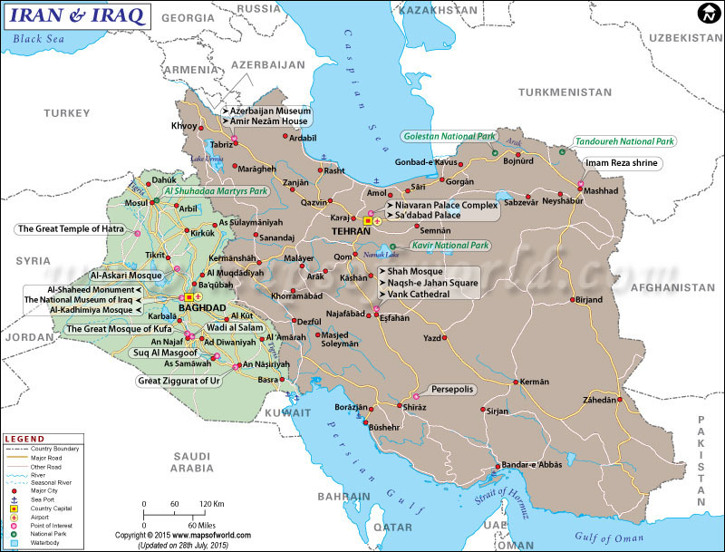
Map of Iran and Iraq
Iran and Iraq are two sovereign nations located in Western Asia. The two nations comprise a rich history, culture, and traditions.
Iran is an Islamic Republic and comprises a population of 81,000,000 people, which makes it the 18th most populous country in the world. The second largest country by area in the Middle East and the 17th in the world, Iran shares its borders with Armenia, Azerbaijan, Turkmenistan, Afghanistan, Turkey and Iraq. Tehran is the capital as well as the largest city of the country. A prominent regional player, Iran is the founding member of several organizations such as OIC, NAM, OPEC, UN, and ECO. The nation is also home to 21 UNESCO World Heritage Sites. There are numerous ethnic and linguistic groups living in Iran. Persians, who comprise 61 percent of the population, are the largest group. Other groups are Kurds, Azeris, and Lurs.
Iraq is the 58th largest country in the world comprising an area of 168,754 square miles. With a population of 37,202,572 inhabitants, as of 2016, it is the 36th most populous country in the world. Baghdad is the capital as well as the largest city of the country. Officially known as the Republic of Iraq, the nation shares its borders with Turkey, Iran, Kuwait, Saudi Arabia, Jordan, and Syria. Arabs and Kurds are the main ethnic groups. Other groups in the country are Turkmen, Armenians, Assyrians, Yazidis, Shabakis, Mandeans, Circassians, and Kawliya.
Relations between Iran and Iraq became tense following the overthrow of the Hashemite Monarchy in 1958. The two countries witnessed a period of warfare from 1980 to 1988. The war claimed the lives of more than a million people and caused huge economic damages. The two nations normalized relations following the downfall of Saddam Hussein in 2003. More than 100 economic and cooperation agreements have been signed between the two nations as of 2010.
The Map of Iran and Iraq depicts the location of the two nations, international boundaries, neighboring countries, major cities and country capitals. The major and other roads, rivers, sea ports, airports, national parks, points of interest, etc, are also clearly demarcated on the map.
Last Updated on: October 5th, 2017


