Mountain West Region Map
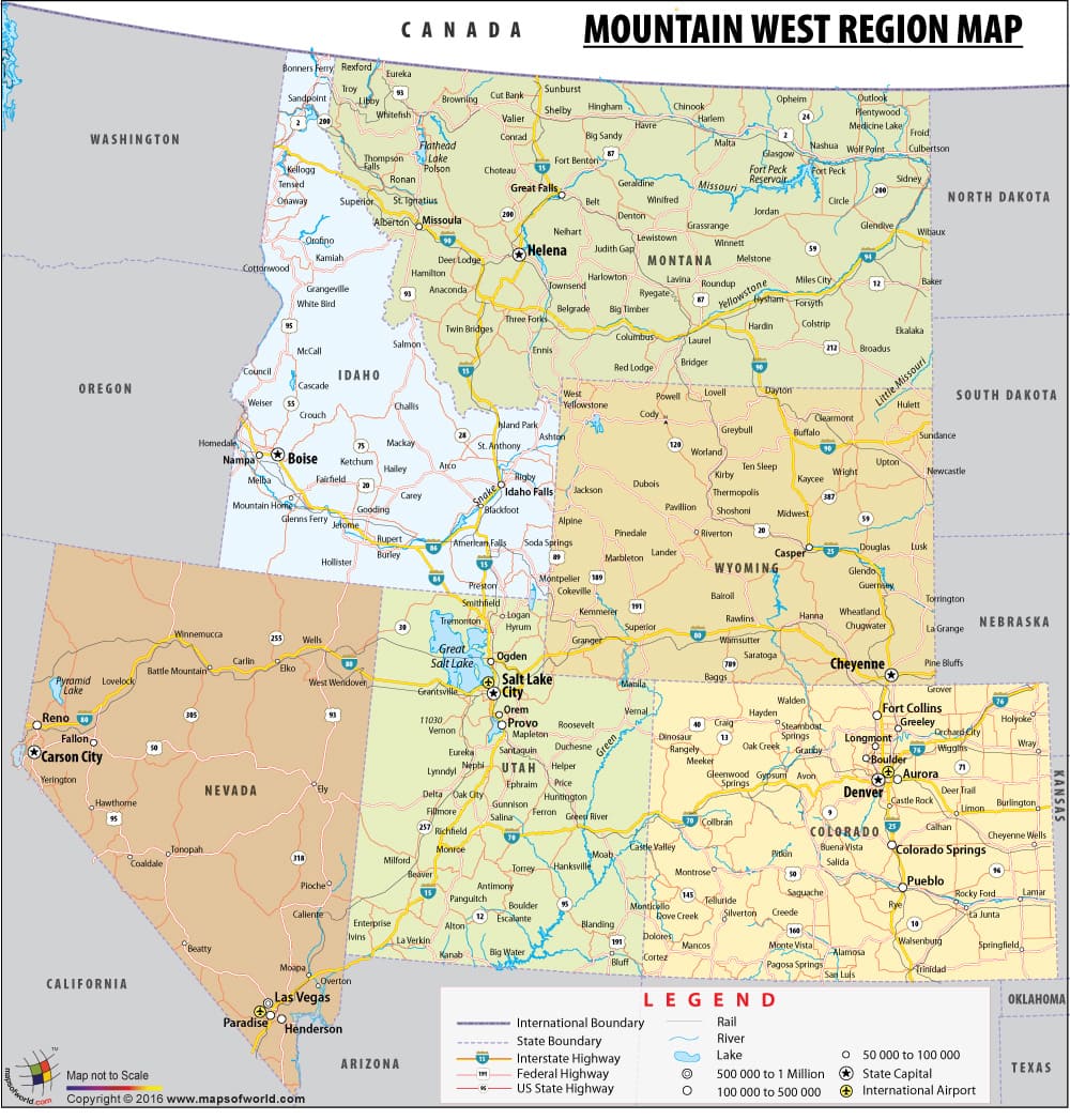
The map depicts the Mountain States of the United States which is a sub-region of the western part of the country. It is also referred as Mountain West and the Interior West. The map depicts the six states Colorado, Nevada, Utah, Wyoming, Idaho and Montana.
The map depicts the major Interstate and Federal Highways that run through these states. Some of these are NH 52, NH 93, NH 50, NH 71, NH 95 and others. Also displayed are the capitals of these states such as Helena, the capital of Montana; Boise, the capital of Idaho; Cheyenne, the capital of Wyoming, Carson City, the capital of Nevada; Utah’s capital Salt Lake City; and Denver, Colorado’s capital. Other than the capitals, the map also shows the prominent cities of these states. Some of these are Las Vegas, Provo, Aurora, Colorado Springs, Boulder, Casper, and Great Falls to name a few.
The Mountain States have a diverse terrain. These states comprise high mountain peaks, desert lands, and rolling plains. Some prominent deserts located here are the Great Basin Desert, San Rafael Desert, among others. Some of the highest peaks here aew Granite Peak, Pikes Peak, Kings Peak, Longs Peak, Cloud Peak etc. The climate ranges from Semi Arid to Arid.
Some prominent attractions in the region are the Grand Canyon, Great Sand Dunes National Park, the Cliff Palace, Hanging Lake, Borah Peak Redfish Lake, and many others.
PB06.02.2017
