logo


Guinea Bissau Latitude and Longitude Map

Guinea Bissau's latitude and longitude is 12° 00' N and 15° 00' W . Below is the map of Guinea Bissau showing major towns, roads, airports with latitudes and longitudes plotted on it.
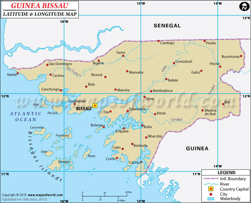
Guinea Bissau Latitude and Longitude Map Senegal Latitude and Longitude Map Guinea Latitude and Longitude Map
Description : Find Guinea Bissau latitude and longitude map showing comprehensive details including cities, roads, towns, airports and much more. Disclaimer
×

Disclaimer  :  All efforts have been made to make this image accurate. However MapSherpa, Inc, its directors and employees do not own any responsibility for the correctness or authenticity of the same.


Search For Latitude & Longitude Map

By Country

Or

Latitude

Longitude

Or

Area

* Put South & West values with minus ( - ) sign.


The latitude and longitude of Guinea-Bissau is 12º 00' N and 15º 00' W respectively. It is located in western Africa and lies between Guinea and Senegal.

The total area is slightly smaller than three times that of Connecticut. Bissau, the capital is located in 11º 51' N and 15º 35' W latitude and longitude respectively. Guinea-Bissau consists of 9 regions and is five hours ahead of Washington DC during Standard Time.

The total area of Guinea-Bissau is 36,120 square kilometers with a coastline extending up to 350 kilometers. The terrain of the region is mostly low coastal plain with savanna lands in the east. The western coast is swampy and low-lying in the interiors. The climate of Guinea-Bissau is mostly tropical comprising of hot and humid summers and a monsoonal type of rainy season stretching from June to November. The dry season spans from December to May and northeasterly harmattan winds are common in this season. These winds reduce the visibility during summers and even brush fires among the trees.

Latitude and Longitude of Guinea Bissau

LocationLatitudeLongitude
Bijagos, Arquipelago dos11°15'N16°10'W


Last Updated on: November 16th, 2017