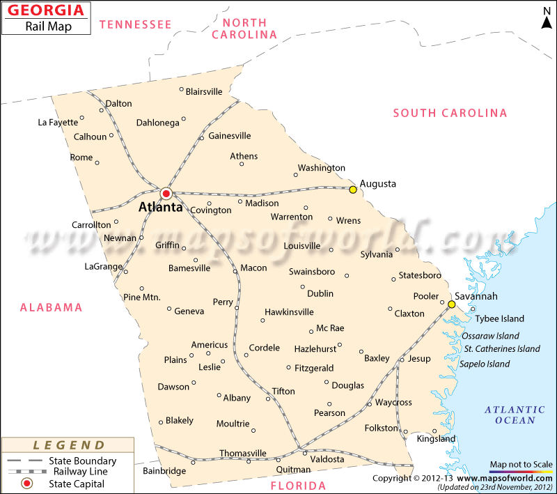
Georgia Railway Network Map
This Georgia Railroad Map shows detailed information on the railway system and stations in the state of Georgia.
Rail services make Georgia easily accessible from all parts of the United States of America. Georgia’s first rails were laid in 1830, and today the Georgia Railroad Association helps develop and maintain the infrastructure of the state’s railway industry.
Georgia rails offer exciting trips through the state. The Blue Ridge Scenic Railway gives tourists a wonderful opportunity to explore the picturesque Toccoa River landscape. The Historic St. Mary’s Railway connects St. Mary’s station with Kingsland in Georgia’s far southeast corner. The SAM Shortline, meanwhile, provides touring riders with a unique view of the natural splendor of southwestern Georgia.
Several railroad museums reflect Georgia’s rich railway history. These museums house many coaches, railway tracks, and steam engines of bygone eras. The Roundhouse Railroad Museum, Roosevelt Railroad Museum, Southeastern Railroad Museum, Tallulah Falls Railroad Museum, and the Southern Museum of Civil War and Locomotive History are some of the notable museums in the state of Georgia.
 Wall Maps