1.2K
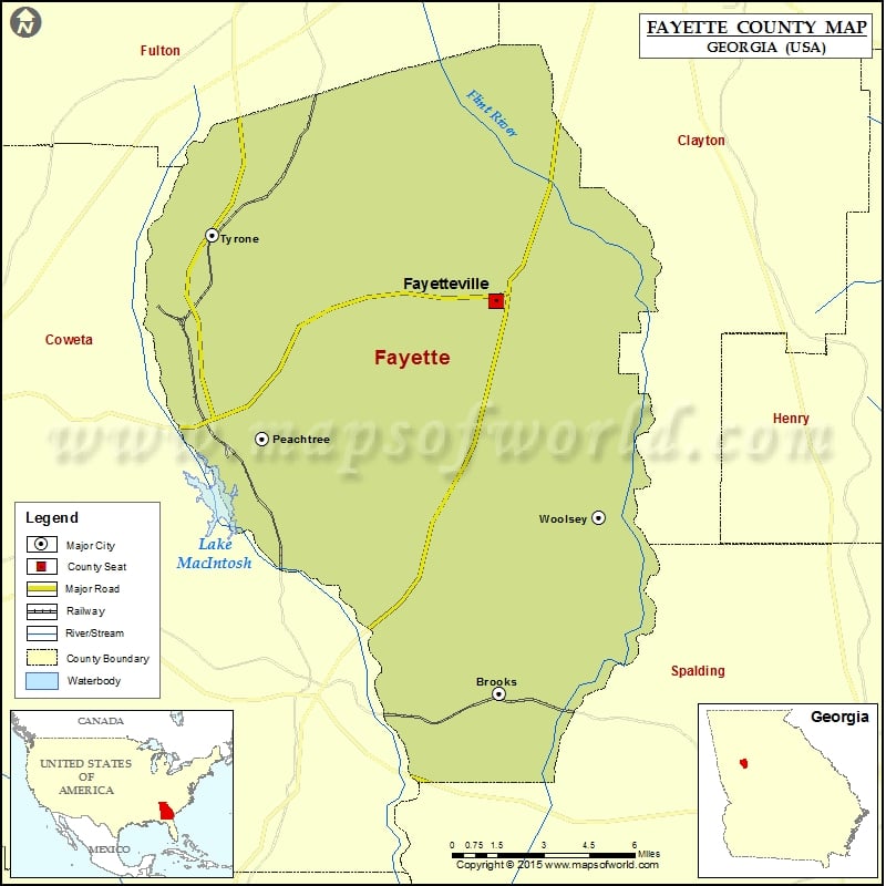
Check this Georgia County Map to locate all the state’s counties in Georgia Map.
Airports in Fayette County
| Airport Name |
|---|
| Adams Airport |
| Beck Field |
| Bishops Airport |
| Coleman Field |
| Kenley Field |
| Mc Lendon Airport |
| Peachtree City Falcon Field |
| Public Safety Heliport |
| Rust Airstrip |
| Smith Field |
| Walker Field |
| Willow Pond Aviation Inc Airport |
More Maps of Fayette County
Cities in Fayette County
| City | Population | Latitude | Longitude |
|---|---|---|---|
| Brooks town | 524 | 33.292482 | -84.458797 |
| Fayetteville city | 15945 | 33.448726 | -84.460361 |
| Peachtree City city | 34364 | 33.39424 | -84.5711 |
| Tyrone town | 6879 | 33.474917 | -84.594359 |
| Woolsey town | 158 | 33.36262 | -84.41126 |
Golf Courses in Fayette County
| Name of Golf Course | Latitude | Longitude |
|---|---|---|
| Braelinn Golf Club-Peachtree City | 33.367839 | -84.541515 |
| Canongate At Flat Creek Club-Peachtree City | 33.4021 | -84.581847 |
| Canongate At Planterra Ridge-Peachtree City | 33.369727 | -84.581822 |
| The Links Golf Club-Jonesboro | 33.479524 | -84.400594 |
| Wendell Coffee Golf Center-Tyrone | 33.515429 | -84.576036 |
| Whitewater Creek-Fayetteville | 33.379444 | -84.50786 |
 Wall Maps