logo


Mauritius Latitude and Longitude Map

Mauritius's latitude and longitude is 20° 17' S and 57 ° 33' E . Below is the map of Mauritius showing major towns, roads, airports with latitudes and longitudes plotted on it.
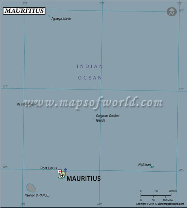
Mauritius Latitude and Longitude Map France Lat Long Map
Description :  Find Mauritius latitude and longitude map showing comprehensive details including cities, roads, towns, airports and much more. Disclaimer
×

Disclaimer  :  All efforts have been made to make this image accurate. However MapSherpa, Inc, its directors and employees do not own any responsibility for the correctness or authenticity of the same.


Search For Latitude & Longitude Map

By Country

Or

Latitude

Longitude

Or

Area

* Put South & West values with minus ( - ) sign.

Mauritius is located within the latitude and longitude of 20° 17 S, 57 º 33 E. Mauritius is located in Southern Africa.

It is basically a group of islands located in the Indian Ocean. The capital city of Mauritius is Port Louis. The latitude and longitude of Port Louis, the capital city of Mauritius country is 20º 10' S, 57 º 30' E. Mauritius is 9 hours ahead of Washington, DC during Standard Time.

The latitude and longitude of Mauritius includes 2,040 sq km of total land area. In the centre of the small coastal area there is a plateau, with its highest peak in the southwest called, Piton de la Petite Rivière Noire. The climate within this latitude and longitude of Mauritius is tropical in nature. Here the winter season continues from the month of May to November. The summer season which lasts from November to May is generally very hot, wet and humid in nature.

Locations Latitude Longitude
Port Louis20°10'S57°30'E


Last Updated on: November 18th, 2017