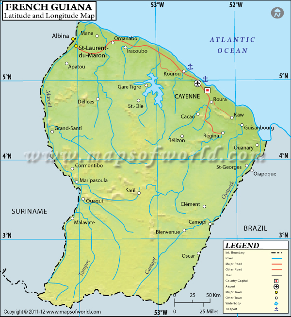
The French Guiana is geographically located at the Latitude of 4°00'N and the Longitude of 53°00'W in South America.
The Latitude and Longitude of French Guiana spans across an area of 83,534 sq km. The capital of French Guiana is Cayenne with a Latitude and Longitude of 4° 56' N and 52° 27' W respectively.
The geographic location of French Guiana causes it to have a typically tropical climate with hot and humid summers and little variation in seasonal temperatures. The coastal terrain of French Guiana is almost flat, broken only by occasional hills and mountains. French Guiana has a population of 202,000 and composed of Mulattos, Haitians, Europeans, Asians, Maroons and Amerindian tribes like the Arawak, the Wayana, the Galibi and the Emerillon.
As an overseas territory of France, even though it is physically located in the continent of South America, French Guiana is part of the European Union.
Latitude and Longitude of French Guiana |
|---|
| Location | Latitude | Longitude |
|---|
| Approuague | 04°30'N | 51°57'W |
| Mana | 05°45 'N | 53°55'W |
| Maroni | 05°30'N | 54°0'W |
Last Updated on: November 14th, 2017


