logo


Finland Latitude and Longitude Map

Finland's latitude and longitude is 64° 00' N and 26° 00' E . Below is the map of Finland showing major towns, roads, airports with latitudes and longitudes plotted on it.
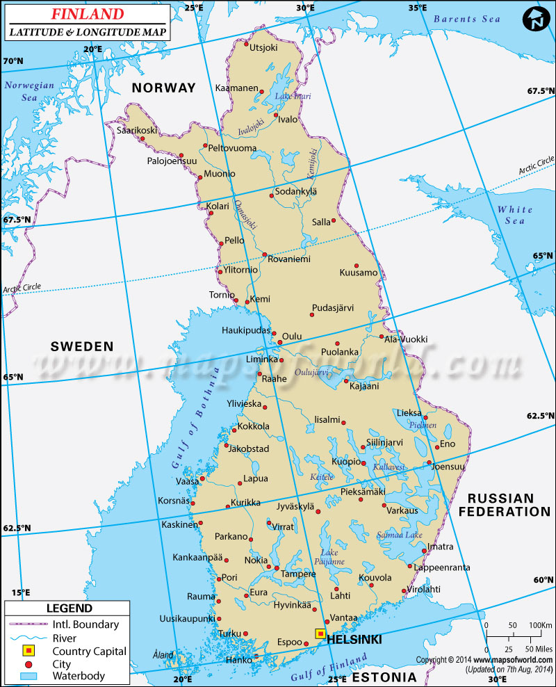
Finland Latitude and Longitude Map
Norway Latitude and Longitude Map Sweden Latitude and Longitude Map Russia Latitude and Longitude Map Estonia Latitude and Longitude Map
Description : Find Finland latitude and longitude map showing comprehensive details including cities, roads, towns, airports and much more. Disclaimer
×

Disclaimer  :  All efforts have been made to make this image accurate. However MapSherpa, Inc, its directors and employees do not own any responsibility for the correctness or authenticity of the same.


Search For Latitude & Longitude Map

By Country

Or

Latitude

Longitude

Or

Area

* Put South & West values with minus ( - ) sign.

Finland gets its name from the Germanic Finn, meaning Hunter. Within its geographical coordinates the Scandinavian country of Finland has an area of 338,145 square kilometer. Out of this 33,672 sq km consists of water bodies. There are around 187,888 lakes of varying sizes in Finland.

The Saimaa Lake is the largest water body in Finland, located at the Latitude and Longitude of 61°15'N and 28°15'E. The capital of Finland is Helsinki, having a Latitude and Longitude of 60°10'N and 24°56'E respectively.


Because of its geographic location, Finland is subject to an almost sub-arctic weather; however the climate is typically temperate because of the presence of the Warm North Atlantic Currents near its coast. Finland has a flat, low lying terrain out which 6°54% is fertile land. The highest point is the Haltiatunturi with a height of 1,328 m.

Last Updated on: November 14th, 2017