logo


Grenada Latitude and Longitude Map

Grenada's latitude and longitude is 12° 07' N and 61° 40' W . Below is the map of Grenada showing major towns, roads, airports with latitudes and longitudes plotted on it.
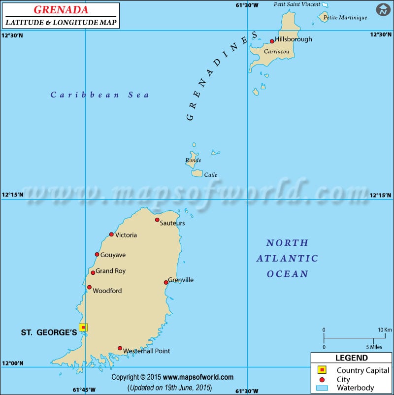
Grenada Latitude and Longitude Map
Description : Find Grenada latitude and longitude map showing comprehensive details including cities, roads, towns, airports and much more. Disclaimer
×

Disclaimer  :  All efforts have been made to make this image accurate. However MapSherpa, Inc, its directors and employees do not own any responsibility for the correctness or authenticity of the same.


Search For Latitude & Longitude Map

By Country

Or

Latitude

Longitude

Or

Area

* Put South & West values with minus ( - ) sign.


The latitude and longitude of Grenada is 12º 07' N and 61º 40' W respectively. It is located on the Caribbean Island and lies between Caribbean Sea and Atlantic Ocean.


The total area of Grenada is twice the size of Washington DC. Saint George's, the capital, is located on 12º 03' N and 61º 45' W latitude and longitude respectively. Grenada comprises of 6 parishes and 1 dependency. Grenada is one hour ahead of Washington DC during Standard Time.

The total area of Grenada is 344 square kilometers and the coastline extends to 121 kilometers. The terrain of Grenada is volcanic in origin with central mountains. The climate of Grenada is mostly tropical but tempered by northeast trade winds. The region lies on the edge of the hurricane belt and as a result, hurricanes are quite common from June to November. The area currently faces no environmental concerns or hazards.

Latitude and Longitude of Gibraltar

LocationLatitudeLongitude
Hillsborough12°28'N61°28'W
St. Georges12°5'N61°43'W

Last Updated on: November 14th, 2017