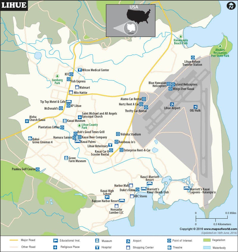
Facts about Lihue City |
|---|
| Country | USA (United States of America) |
|---|---|
| State | Hawaii |
| County | Kauai County |
| Total Area | 7.1 sq miles |
| Lat Long Coordinates | 21.9811° N, 159.3711° W |
| Time Zone | HAST (UTC−10:00) |
| Area Code | 808 |
| Language | English |
| Major Religion | Roman Catholic, Christian |
| Museums | Kauai Museum, Grove Farm Homestead Museum |
Tourist Attraction:
|
Lihue is a city in the U.S state Hawaii. It is the second largest town on the Hawaiian Island of Kaua’i. The city’s name Lihue means “cold chill“. It was a minor village before it grew into a small city. It is the county seat of Kaua’i County and is also home to the county administration building. The city is also the cultural and business center of Kauai.
Hotels:
A few of the well liked eminent Hotels are as following:
Garden Island Inn
Aston Kauai Beach Villas
Banyan Harbor Resort
Kauai Marriot Resort and Beach Club
Castle Kaha Lani Resort
Hilton Kauai Beach Resort
Transportation:
Lihu’e Airport serves the city. Nawiliwili Bay, the main seaport for Kaua’I which handles cruise ships is another means to access the city from other parts of the world. Cars, taxis are also available in the city.
 Wall Maps
