5.6K
- Nevada Counties - Nevada County Map, Map of Nevada Counties
- Major Cities of Nevada - Las Vegas
- Neighbouring States - Oregon, Idaho, Utah, Arizona, California,
- Regional Maps - Map of USA
- Other Nevada Maps - Nevada Map, Nevada Physical Map, Nevada Airports Map, Nevada Lat Long Map, Nevada Zip Code Map, Nevada Area Code Map, Nevada National Parks Map
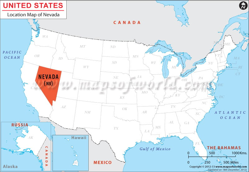
Where is Nevada Located
Nevada is located in the western part of the US. The Nevada Location Map highlights nearby regions, neighbouring US countries like Mexico and Canada, and bodies of water including the Atlantic Ocean, Pacific Ocean, and the Gulf of Mexico. Nevada share its borders with California to the west, Oregon & Idaho to the North and with Utah & Arizona to the East.
Facts About Nevada |
|---|
| State Name | Nevada |
|---|---|
| Continent | North America |
| Country | United State (USA) |
| Capital | Carson City |
| Largest city | Las Vegas |
| Area | 110,622 sq mi (286,367 km2) |
| Population | 2,839,099 (2014 est) |
| Lat Long | 39° 0′ 0″ N, 117° 0′ 0″ W |
| Official Language | De jure: None , De facto: English |
| Calling Code | 00 1 775 X Carson City, 00 1 702 X Las Vegas |
| Time Zone | Pacific: UTC −8/−7, Mountain: UTC −7/−6 |
| Airport | 6-Airports Scheduled Service |
| Neighbour State | California, Arizona, Utah, Idaho, Oregon |
| Internet TLD | .nv |
| Currency | United State Dollar (USD) |
 Wall Maps