1.5K
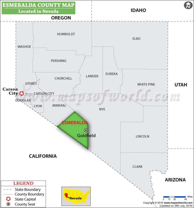
Facts about Esmeralda County
| County | Esmeralda |
| State | Nevada |
| Country | USA |
| Population – 2015 | 829 |
List of Counties in Nevada |
|||||
|---|---|---|---|---|---|
| County Name | County Seat/Capital | State | 2010 pop. | Area-km | Area-mi |
| Carson City | Carson City | Nevada | 55,274 | 375 | 145 |
| Churchill | Fallon | Nevada | 24,877 | 12,770 | 4,930 |
| Clark | Las Vegas | Nevada | 19,51,269 | 20,439 | 7,891 |
| Douglas | Minden | Nevada | 46,997 | 1,838 | 710 |
| Elko | Elko | Nevada | 48,818 | 44,470 | 17,170 |
| Esmeralda | Goldfield | Nevada | 783 | 9,277 | 3,582 |
| Eureka | Eureka | Nevada | 1,987 | 10,815 | 4,176 |
| Humboldt | Winnemucca | Nevada | 16,528 | 24,969 | 9,641 |
| Lander | Battle Mountain | Nevada | 5,775 | 14,219 | 5,490 |
| Lincoln | Pioche | Nevada | 5,345 | 27,540 | 10,633 |
| Lyon | Yerington | Nevada | 51,980 | 5,183 | 2,001 |
| Mineral | Hawthorne | Nevada | 4,772 | 9,720 | 3,753 |
| Nye | Tonopah | Nevada | 43,946 | 47,091 | 18,182 |
| Pershing | Lovelock | Nevada | 6,753 | 15,635 | 6,037 |
| Storey | Virginia City | Nevada | 4,010 | 681 | 263 |
| Washoe | Reno | Nevada | 4,21,407 | 16,323 | 6,302 |
| White Pine | Ely | Nevada | 10,030 | 22,988 | 8,876 |
 Wall Maps