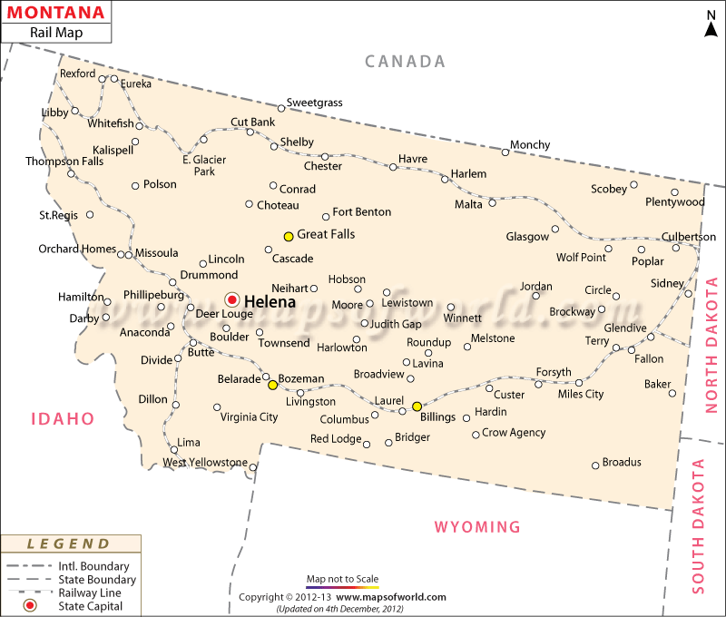
All passenger rail service in the state of Montana is provided by Amtrak. There are 12 stations within the state, all along the Empire Builder. The Empire Builder – running between Chicago and the Pacific Northwest – is the Amtrak’s busiest long-distance route. The route enters from North Dakota and extends into Idaho while serving communities in northern Montana.
Current Amtrak stations in Montana –
- Browning
- Cut Bank
- East Glacier Park
- Essex
- Glasgow
- Havre
- Libby
- Malta
- Shelby
- West Glacier
- Whitefish
- Wolf Point
Among the common freight carriers in Montana include BNSF Railway (BNSF), Dakota, Missouri Valley and Western Railroad (DMVW), Montana Rail Link (MRL), Union Pacific Railroad (UP), and Yellowstone Valley Railroad (YSVR). In terms of overall freight transportation, the BNSF Railway is the largest railroad in Montana, with 1,983 miles (3,191 km) of track in the state. Montana Rail Link is a Class II railroad that serves 100 stations runs along 817 miles (1,315 km) of track. Its main line serves Missoula, Livingston, Bozeman, Billings, and Helena. Central Montana Rail extends nearly 84.2 miles while serving Judith Basin, Fergus, and Chouteau Counties. Montana also has historical railroads which existed during the industrial boom of the 19th and 20th century.
MOW.DT.12.21.16
 Wall Maps