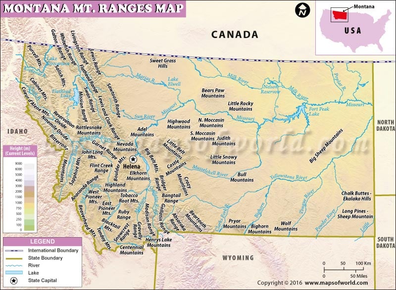
Located in the western region of the United States, Montana is a landlocked state. While its shares its borders with the US states of North Dakota, South Dakota, Wyoming and Idaho to the east, south, west and southwest, it also borders the three Canadian provinces of British Columbia, Alberta, and Saskatchewan. Montana is the fourth largest state of the US. It is a mountainous state, especially the western part which comprises most of the state’s more than 100 mountain ranges. Many of these mountain ranges form a part of the Northern Rocky Mountains. Many smaller mountain ranges can be found throughout the state. The Granite Peak, which has a height of 12,807 feet and is located along the state’s border with Wyoming, is the highest point in the Montana. Some prominent mountain ranges in the state include Absaroka Range, Anaconda Range, Beartooth Mountains, Bitterroot Mountains, Cabinet Mountains, Gallatin Range, Lewis and Clark Range, and many others.
The amp of the mountain ranges of Montana lists all the ranges found in the state along with their accurate description. From the small to the large, every mountain range is depicted on the map. Other than the mountain ranges, the state also depicts the other features of Montana such as its capital Helena, the state boundary which demarcates it from its US neighbors as well as the international boundary which separates it from Canada. The map is particularly useful for students, teachers and researchers.
MOW.PB. 20.12.2016
 Wall Maps