- National Park Maps of Neighbouring States - Michigan National Parks, Ohio National Parks, Kentucky National Parks
- National Parks in Indiana - Hoosier National Forest, Indiana Dunes National Park
- US National Parks Map
National Parks in Indiana
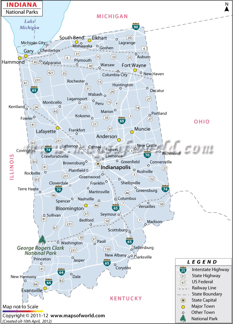
National Parks in Indiana highlights the national parks and historical sites of the state. The Golden sandy beach and the serene ambience represent the Indiana Dunes National Lakeshore. The national park organizes several educational programs and adventurous activities for children and adults alike.
The Lincoln Boyhood National Memorial is another interesting tourist destination in Indiana. Abraham Lincoln had spent his childhood and youth on this farmland. The Lincoln Boyhood National Memorial was constructed in the memory of the great President of the United States of America. The memorial houses several books, journals and photographs of Abraham Lincoln.
How many National Parks are there in Indiana?
There is only one National Park in the state of Indiana. There are also two commemorative sites in Indiana. National Historic Trails recognize original trails or routes of historical significance. Lincoln Boyhood National Memorial and Lewis and Clark National Historic Trail.
-
Indiana Dunes National Park
The site is known for its Picturesque Landscape. The Golden Sandy beach and the serene ambience represent the Indiana Dunes National Lakeshore. The park hugs 15 miles of the southern shore of Lake Michigan. The park organizes several educational programs and adventurous activities for children and adults alike. Check out this Indiana Dunes National Park Map for all the things you need to know about the national park before visiting.
Top National Parks in Indiana |
|---|
| S. No | Name | Area | Established | Location |
|---|---|---|---|---|
| 1 | George Rogers Clark National Historical Park | 24.3 acres (9.8 ha) | Jul 23, 1966 | 2nd St, S of U.S. 50, Vincennes, Indiana, United States |
Things to Do in National Parks in Indiana
- Visit Clark Memorial: The George Rogers Clark National Historical Park offers the tourists with a wonderful opportunity to explore the rich architecture of the Clark Memorial. The National houses several elegant structures that speak volumes about the unique history of the state.
- Camping: Overnight camping is available from April 1 through October 31 at the Dunewood Campground in Indiana Dunes National Park.
- Fishing and Boating: Fishing is allowed under federal, state and local laws. You need an Indiana Fishing License and a stamp if fishing for trout and salmon. Watch for drop-offs in creeks and along beaches.
- Geocaching: Geocaching is an outdoor adventure where players (called geocachers) use a Geocaching app to find hidden containers around the world. Visit Geocaching.com or download the free Official Geocaching app to begin geocaching.
Best Time to Visit National Parks in Indiana
There is no one-size-fits-all trip to National Parks in Indiana. As the season changes, so do the recreational opportunities, park facility, operating hours, closures and safety concerns. Each season offers new and different ways to enjoy Indiana Dunes, National Park.
- Spring Season: Spring splashes the river banks of the Heron Rookery with an abundance of Colorful wildflowers in this birder’s paradise.
- Fall Season: In the Fall, Maple trees burst with warm red and golden hues, forming a spectacular backdrop for a hike by the Chellberg Farm.
- Winter Season: winter brings a scenic canvas of white snow for cross-country skiing adventures in the Glenwood Dunes. Hiking and snowshoeing are popular in the wintertime.
