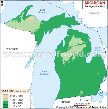
The topography of Michigan is characterized by flat lands. Situated in the southeastern part of Michigan, Lake Erie at 571 feet (174 m) is the lowest point of the State of Michigan. Mt. Arvon, at an altitude of 1,979 feet (603 m) is the highest point of Michigan. The eastern part of Michigan is characterized by low land areas and the western part of the state comprises hilly regions of the Upper Peninsula. Several rivers and lakes flow through the State of Michigan. Houghton Lake is the biggest lake of Michigan. Grand, Pere Marquette, St. Joseph, Kalamazoo and Manistee are the important rivers of Michigan. The lower portion of peninsular region is drained by River Grand. Most of the islands of Michigan State are located in the northern part of Lake Huron and Lake Michigan. The island of Isle Royale is situated to the north of Lake Superior. The Beaver Island is the biggest island of Lake Michigan. Located in the eastern end of the Upper Peninsula, the Drummond Island is the biggest island of the northern area of Lake Huron. The Michigan State Map clearly indicates the heterogeneous topography of the state.
Michigan Topographic Map
The Michigan Topographic Map points out the relief features of the state.
1.9K
previous post
