2.8K
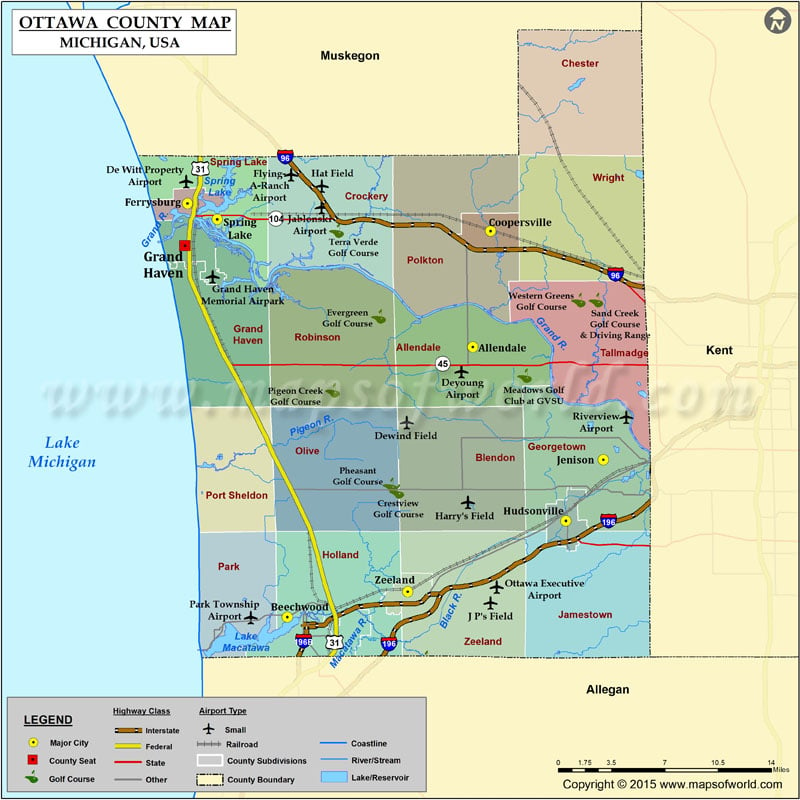
Airports in Ottawa County
| Airport Name |
|---|
| De Witt Property Airport |
| Dewind Field |
| Deyoung Airport |
| Flying-A-Ranch Airport |
| Grand Haven Memorial Airpark |
| Harry’s Field |
| J P’s Field |
| Jablonski Airport |
| Lloyd’s Field |
| Ottawa Executive Airport |
| Park Township Airport |
| Riverview Airport |
Cities in Ottawa County
| City | Population | Latitude | Longitude |
|---|---|---|---|
| Allendale | 17579 | 42.985061 | -85.950933 |
| Beechwood | 3015 | 42.796133 | -86.127398 |
| Coopersville city | 4275 | 43.06579 | -85.934103 |
| Ferrysburg city | 2892 | 43.085046 | -86.222189 |
| Grand Haven city | 10412 | 43.055665 | -86.224739 |
| Hudsonville city | 7116 | 42.863445 | -85.862499 |
| Jenison | 16538 | 42.906327 | -85.826916 |
| Spring Lake village | 2323 | 43.073995 | -86.193996 |
| Zeeland city | 5504 | 42.813916 | -86.012914 |
 Wall Maps