2.3K
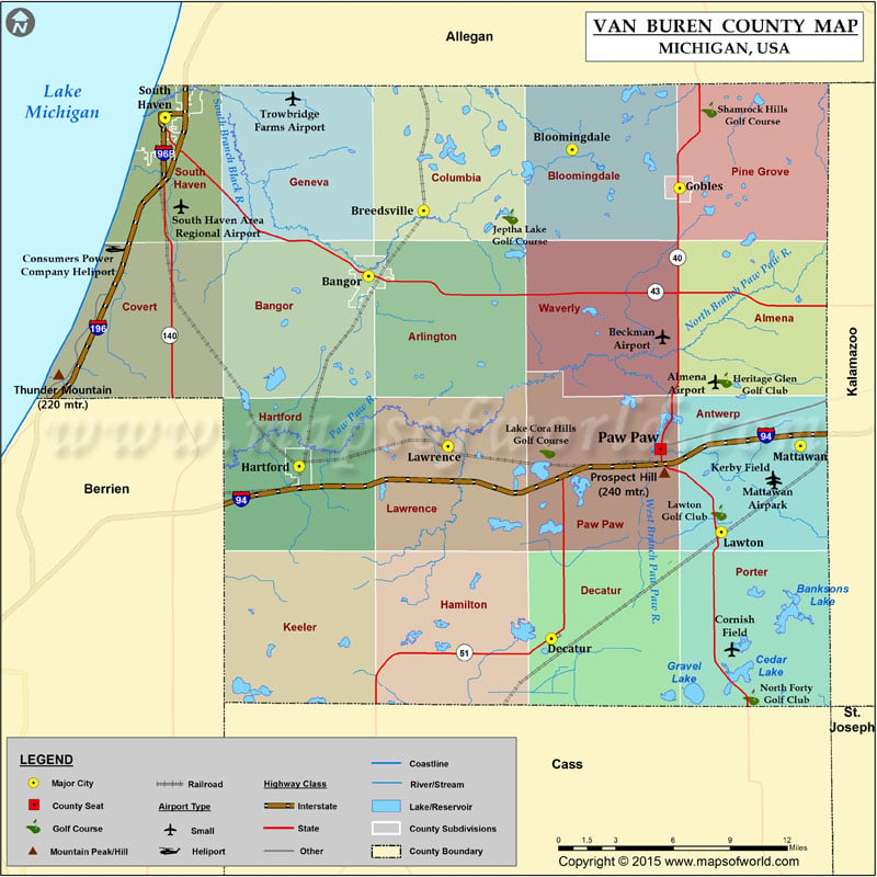
Mountain Peaks in Van Buren County
| Mountain Peak/Hill | Elevation [Meter] |
|---|---|
| Prospect Hill | 240 |
| Thunder Mountain | 220 |
More Maps of Van Buren County
Airports in Van Buren County
| Airport Name |
|---|
| Almena Airport |
| Beckman Airport |
| Consumers Power Company Heliport |
| Cornish Field |
| Good Shepherd Hospital Heliport |
| Heller Airport |
| Kerby Field |
| South Haven Area Regional Airport |
Cities in Van Buren County
| City | Population | Latitude | Longitude |
|---|---|---|---|
| Bangor city | 1885 | 42.31205 | -86.11327 |
| Bloomingdale village | 454 | 42.383283 | -85.959033 |
| Breedsville village | 199 | 42.348878 | -86.071743 |
| Decatur village | 1819 | 42.10758 | -85.97464 |
| Gobles city | 829 | 42.361652 | -85.877392 |
| Hartford city | 2688 | 42.204948 | -86.166025 |
| Lawrence village | 996 | 42.216205 | -86.05315 |
| Lawton village | 1900 | 42.167822 | -85.845902 |
| Mattawan village | 1997 | 42.216505 | -85.78582 |
| Paw Paw village | 3534 | 42.214743 | -85.892059 |
| South Haven city | 4403 | 42.401278 | -86.267533 |
 Wall Maps