1.2K
Mountain Peaks in Kent County
| Mountain Peak/Hill | Elevation [Meter] |
|---|---|
| Bettes Tower Hill | 262 |
| Cheney Hills | 290 |
| Dias Hill | 318 |
More Maps of Kent County
Airports in Kent County
| Airport Name |
|---|
| Amway Downtown Heliport |
| B & G Heliport |
| Blodgett Memorial Medical Center Heliport |
| Butterworth Hospital Heliport |
| Chan Gurney Municipal Airport |
| Cridler Airport |
| Cupp/Sjvs Landing Strip |
| East-West Paris Airport |
| Erin Aero Airport |
| Gerald R. Ford International Airport |
| Kohlhaas Airport |
| Martin Fierro Airport |
| Memorial Hospital Heliport |
| North Cedar Airport |
| Paul C. Miller-Sparta Airport |
| Somerville Airport |
| St Mary’s Hospital Heliport |
| Sumner Heliport |
| Tyrone Airport |
| Van Strien Company Airport |
| Wells Airport |
| Wells Airport |
| Wilds Field |
| Wisersky Airport |
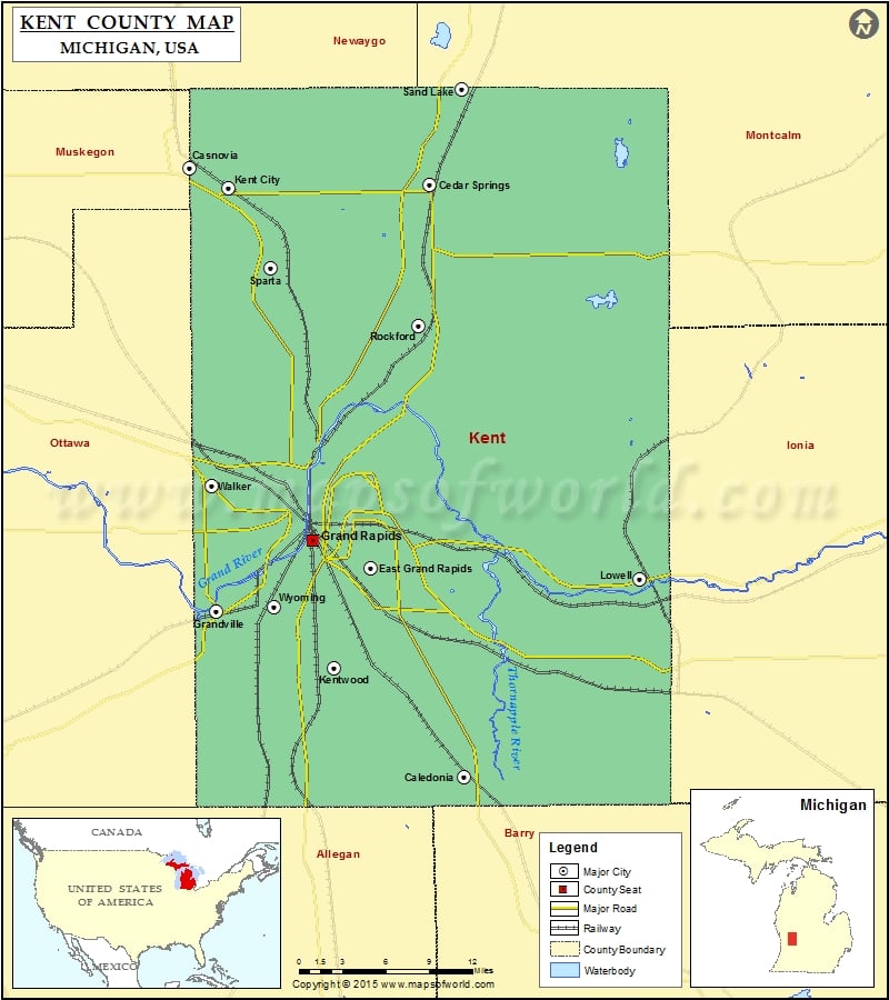
Cities in Kent County
| City | Population | Latitude | Longitude |
|---|---|---|---|
| Byron Center | 5822 | 42.812124 | -85.72793 |
| Caledonia village | 1511 | 42.794376 | -85.515288 |
| Casnovia village | 319 | 43.233601 | -85.789508 |
| Cedar Springs city | 3509 | 43.219768 | -85.552994 |
| Comstock Park | 10088 | 43.043773 | -85.677878 |
| Cutlerville | 14370 | 42.840601 | -85.673892 |
| East Grand Rapids city | 10694 | 42.946371 | -85.608813 |
| Forest Hills | 25867 | 42.957647 | -85.489459 |
| Grand Rapids city | 188040 | 42.961482 | -85.655686 |
| Grandville city | 15378 | 42.900236 | -85.75643 |
| Kent City village | 1057 | 43.220226 | -85.753811 |
| Kentwood city | 48707 | 42.88522 | -85.592539 |
| Lowell city | 3783 | 42.935065 | -85.34573 |
| Northview | 14541 | 43.042738 | -85.601621 |
| Rockford city | 5719 | 43.126716 | -85.558287 |
| Sand Lake village | 500 | 43.289975 | -85.519211 |
| Sparta village | 4140 | 43.157618 | -85.709084 |
| Walker city | 23537 | 42.985692 | -85.744295 |
| Wyoming city | 72125 | 42.890975 | -85.706723 |
 Wall Maps