- Michigan Counties - Michigan County Map, Map of Michigan Counties
- Major Cities of Michigan - Detroit, Traverse
- Neighbouring States - Indiana, Ohio, Wisconsin
- Regional Maps - Map of USA
- Other Michigan Maps - Michigan Map, Michigan Physical Map, Michigan Airports Map, Michigan Lat Long Map, Michigan Zip Code Map, Michigan Area Code Map, Michigan National Parks Map
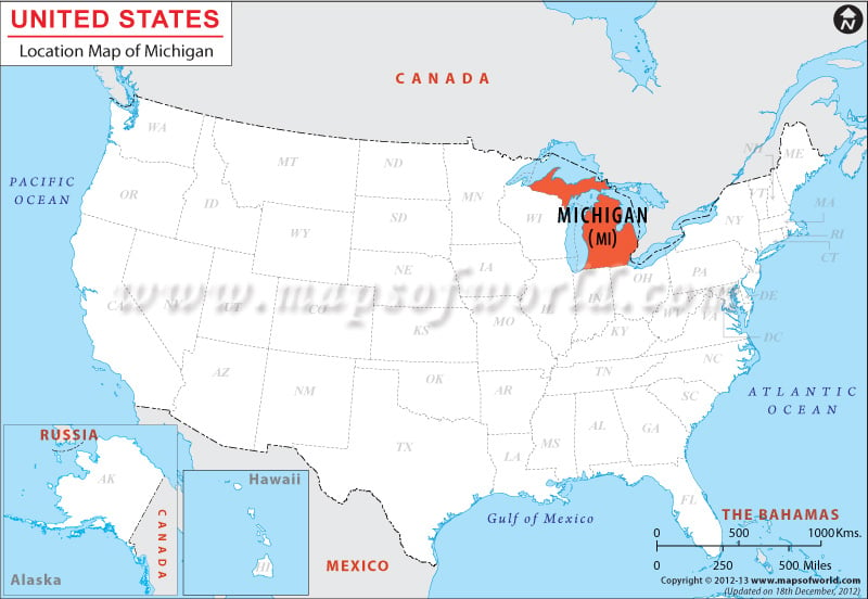
The State of Michigan is surrounded by the Canadian city of Ontario on its northern and eastern border, and by Lake Huron, Lake Michigan, the strait of Mackinac, Ohio and Indiana on its southern side. Illinois and Wisconsin can be found immediately to the west.
Michigan is spread over a total area of 58,527 square miles, with 1,573 square miles of inland waters and a 3,288 miles coastline. The border of Michigan stretches for 1,673 miles in total.
Michigan is a state in the Midwestern USA at coordinates 43.6867° N, 85.0102° W, bordering Wisconsin, Indiana, and Ohio, shares water boundaries with Illinois and parts of Canada. Known as the Great Lake State, Michigan is surrounded by four of the five Great Lakes, and thus has the longest freshwater boundary of any state or country in the world.
The four Great Lakes bordering Michigan are Lake Superior, Lake Michigan, Lake Huron, and Lake Erie. Part of the state, known as the Upper Peninsula, is separated from the rest of the state by Lake Huron and Lake Michigan.
Facts About Michigan |
|
|---|---|
| State Name | Michigan |
| Country | USA |
| Continent | North America |
| Capital | Lansing |
| Largest city | Detroit |
| Area | 96,716 sq mi (250,493 km2) |
| Population | 9,909,877 (2014 est) |
| Lat Long | 44° 0′ 0″ N, 85° 0′ 0″ W |
| Official Language | None (English, de facto) |
| Calling Code | 231, 248 |
| Time Zone | Eastern: UTC −5/−4, Central: UTC −6/−5 |
| Airport | 20 Airports- schedule service |
| Neighbour countries | Canada, Mexico |
| Internet TLD | |
| Currency | US Dollar |
 Wall Maps