
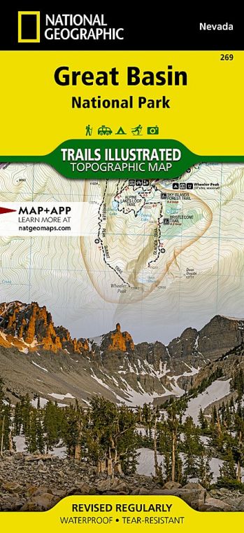
The park occupies a portion of the South Snake Range that rose up 30 million years ago when plate tectonics stretched the Earth’s crust, cracking it into parallel faults. These fractures uplifted into 160 mountain ranges. In between are flat basins where precipitation collects in playas (lake beds).
Buy for $14.95
A first impression of the park as just another mountain rising from the desert floor gives way in the face of its wonders, including ancient bristlecone pines and an Ice Age cirque that cradles Nevada’s only glacier.
Early trappers called this part of the mountain range “Starvation Country” and steered clear. Ranching and farming brought settlers to the Snake Valley in the mid-1860s. Miners and prospectors followed.
But it wasn’t until the discovery of Lehman Caves (actually just one cave) in 1885 that visitors began to flock to the South Snake Range. American explorer and mapmaker John Frémont coined the name Great Basin in the mid-1840s.
Declared a national monument in 1922, the Lehman Caves attracted attention from all over the world, as did the harsh beauty of Wheeler Peak. Talk of a national park ensued, spurred on in 1955 with the rediscovery of an active glacier in Great Basin. When bulldozers uprooted bristlecone pines at mining-claim locations on Mount Washington, appeals for a national park gathered strength.
Today, Great Basin National Park incorporates the Lehman Caves National Monument, Wheeler Peak, and bristlecone pine groves. In the heat of summer, Great Basin provides cool refuge on timberline trails, in forests of limber pine and Engelmann spruce, and deep underground in the intricate marbled cave.
How to Visit
The park is a 4- to-6-hour drive from Reno, Las Vegas, or Salt Lake City, so consider overnighting in Ely, Baker, or camping in the park. Don’t risk missing Lehman Caves by showing up without a reservation (recreation.gov, 877-444-6777). Book the first cave tour of the day, and use the afternoon to drive up Wheeler Peak to hike the Bristlecone Trail. Check the weather forecast before heading out; thunderstorms are not unusual.
Come sunset, linger at one of the overlooks on the way down. Be sure to look up after dark. You don’t want to miss some of the blackest night skies in America. On a moonless night, the Andromeda galaxy can be seen with the naked eye. In summer, park rangers provide night-sky-viewing programs that use high-power telescopes (fee).
Useful Information
How to get there
Whether coming from Reno (387 miles west) on I-80, or from Salt Lake City (238 miles northeast) or Las Vegas (296 miles south) via I-15, you’ll eventually turn onto U.S. 50, the “Loneliest Road in America.” (Check your spare.) Turn south at Nev. 487 and continue 5 miles to the park.
When to go
The park is open year-round, though the upper reach of Wheeler Peak Scenic Drive generally closes Nov. through May depending on weather. Spring wildflowers and fall foliage beckon hikers, but summer brings the highest visitation, when high elevation (6,825 feet at the visitor center) keeps temperatures in the mid-80s. Keep an eye on Wheeler Peak, which has its own weather. Violent thunderstorms appear out of nowhere, mostly in July and Aug. Snow can fall at upper elevations any time of the year.
Visitor Centers
The Great Basin Visitor Center, just north of Baker, is open daily in summer and limited times in fall. Lehman Caves Visitor Center, inside the park, remains open all year.
Headquarters
100 Great Basin National Park Baker, NV 89311 nps.gov/grba 775-234-7331
Camping
Of five park campgrounds, one is open year-round. Others open spring through fall, depending on weather. Most are first come, first served, often filling by midday during summer. No hookups— just vault toilets, water, grills, and a seasonal dump station.
Gateway Tourism Contacts
There is no lodging in the park, but the gateway hamlet of Baker (pop. 68) offers several quirky motels. You’ll find plenty of lodging, including a Prohibition-era hotel (hotelnevada.com) in Ely, 67 miles away (elynevada.net).
US National Parks Map
About the Guide

