
In fact, Canyonlands is as wild today as when John Wesley Powell made the first documented journey down the Green and Colorado Rivers in 1869. Its 527 square miles remain the “most arid, most hostile, most lonesome, most grim, bleak, barren, desolate, and savage quarter of the state of Utah—the best part by far,” according to writer Edward Abbey.
Buy for $14.95
When the Colorado Plateau began uplifting 20 million years ago, its streams carved ever deeper into the sedimentary layers, creating a vast branching network of canyons feeding into the rivers.
Island in the Sky, the most visited park district, hovers 2,200 feet above the Green and Colorado Rivers. As seen from its vertigo-inducing viewpoints, immense red-rock canyons stretch as far as the eye can see, with no evidence of people except the lonely track of the White Rim trail winding along the bench rock.
Ruins and rock paintings of ancestral Puebloans haunt the canyons of The Needles, where Organ rock shale and cedar mesa sandstone have eroded into colorful banded spires.
The lonely Maze district sees the fewest visitors, and not because it is any less alluring. This sandstone labyrinth of look-alike box canyons and impassable cliffs poses a supreme challenge even to veteran hikers.
The Colorado and Green Rivers join forces at the Confluence, the fluid center of the park. Their combined volume rushes into Cataract Canyon, through which churns the most intimidating white water in North America. Yet the river is lulled into submission some 14 miles downstream, beyond the park boundary, by Lake Powell and the Glen Canyon Dam. Other products of human effort are pressing in on park borders. Oil and gas wells springing up near the park have spurred controversial proposals of a Greater Canyonlands National Monument to keep this wild heartland intact.
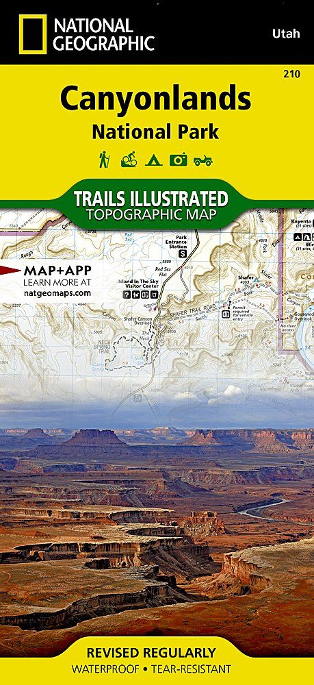
How to Visit
Each of the park’s three districts must be visited separately. As the entrances to The Needles and Island in the Sky are 110 miles apart, visitors with only a half to full day usually prefer Island in the Sky for its car-friendly viewpoints and easier access to both the town of Moab and Arches National Park.
On a second day, head to The Needles for more diverse trails and fewer visitors, or get an early start en route to Horseshoe Canyon; hike in to view the Great Gallery pictographs. Exploring the rugged Maze section is more of a multiday expedition than an excursion, requiring a high-clearance four-wheel-drive vehicle.
Information
How to get there
To reach Island in the Sky from Moab, head north on U.S. 191 for 10 miles to Utah 313, and drive 22 miles to the visitor center. To reach The Needles, head south on U.S. 191 to Utah 211, then west 34 miles to the park entrance. The Maze is reached via I-70, then south on Utah 24. Follow for 25 miles to a signed dirt road, which leads 32 miles to Horseshoe Canyon and 46 miles to Hans Flat Ranger Station.
When to go
Brisk spring and balmy fall are ideal for hiking, though prepare for a wide range of weather conditions. In summer, temperatures often hit triple digits; monsoons bring needed rain— and flash flooding. Mild winters are not uncommon, but even a light snow can close down dirt roads.
Visitor Centers
Island in the Sky and Hans Flat/The Maze visitor centers are open all year; Needles closes early Dec. through Feb.
Headquarters
2282 SW Resource Blvd. Moab, UT 84532 nps.gov/cany 435-719-2100
Camping
There are two campgrounds in the park, the Bates Wilson–designed Squaw Flat Campground (26 sites) in The Needles, and Willow Flat Campground (11 sites) at Island in the Sky. Both are first come, first served and provide vault toilets, fire grates, and tables. To book one of The Needles three group sites (15 to 50 people) or to obtain a permit camping in the backcountry: canypermits.nps.gov.
Lodging
There are no hotels within the park. Moab (discovermoab .com) is a busy tourist town with numerous campground, lodging, and dining options. Monticello and Green River, closer to The Needles and The Maze, offer fewer options.
US National Parks Map
About the Guide

