Yes, there are activities galore, but the park is much more than simply a sunny, fun weekend playground. Visitors who explore Biscayne’s diverse attractions discover a watery world encompassing wildlife, historic shipwrecks, and peaceful lagoons where the loudest sound is the splash of kayak paddles.
The park’s colorful human history begins with the Native American Glades Culture, which left shell mounds in the area that date back more than 2,500 years. In the 19th century, farmers grew pineapples and limes on the Florida Keys; later, Adams Key was home to the Cocolobo Club, a private getaway that hosted several U.S. presidents.
There’s a colorful story behind the establishment of the national park. Conservationists and developers were locked in a bitter, yearslong battle in the 1960s (see p. 30).
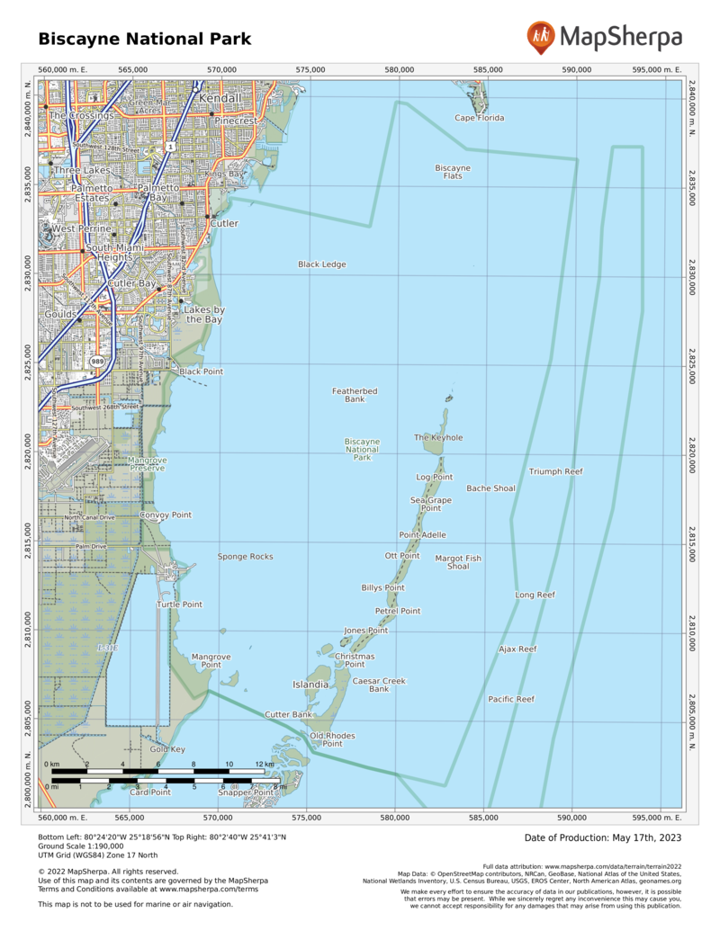
Ninety-five percent of the park area is made up of the waters of Biscayne Bay and the nearby Atlantic Ocean. The park encompasses four ecosystems:
- A narrow strip of mangrove forest bordering the shore of Biscayne Bay
- A large part of the bay itself
- The northernmost islands of the Florida Keys
- The northernmost section of the world’s third largest coral reef, in the Atlantic, just beyond the Keys
Of the park’s lures, what’s most fascinating to many visitors is the array of colorful fish and other animal life that populates the coral reef, from sharks to sea turtles to the coral itself.
How to Visit
At Biscayne National Park, exploration focuses on the water. Take in the exhibits at the Dante Fascell Visitor Center on the mainland and check the schedule for naturalist-led paddling trips (786-335-3612) along the longest mangrove forest on Florida’s east coast. A snorkeling trip to the reef—another water-based activity— is a truly memorable experience.
The park has authorized several concessionaires to operate boat and other tours in the park, making it easy for most visitors to access the bay, the Keys, and the reef. Biscayne National Park Institute (biscayne nationalparkinstitute.org) focuses on ecotours that include paddling, snorkeling, and sailing. A list of other tour operators, available on the park website (nps.gov/bisc/planyourvisit/guidedtours.htm), includes fishing, kiteboarding, and more.
Also consider discovering the park’s watery world on your own. Rent a kayak from an outfitter outside the park and paddle around the quiet mangrove shoreline of the mainland, right near the visitor center. Beginners welcome.
Visitors who take private boats into the park should be aware of regulations applying to both personal safety and protection of the environment. It’s imperative to have nautical charts and to know tide schedules to avoid running aground in shallow water. Coral reefs and other areas of the seafloor are easily damaged by anchors and boat hulls.
Useful Information
How to get there
From Miami, FL (about 35 miles north), take Fla. 821 (Florida’s turnpike) south to Homestead and go east on SW 328 Street to Convoy Point.
When to go
Dec. through April is the most popular season, with moderate temperatures and fewer mosquitoes. Water is calmer and clearer for snorkeling in summer, however.
Visitor Center
The Dante Fascell Visitor Center at Convoy Point is open year-round. Visitors should contact the visitor center before arrival for the latest information on available tours and operators.
Headquarters
9700 SW 328 Street Sir Lancelot Jones Way Homestead, FL 33033 nps.gov/bisc 305-230-1144
Camping
The park’s two campgrounds, on Elliott Key and Boca Chita Key, are accessible only by boat. Elliott has toilets, showers, and drinking water; Boca Chita has only toilets
Lodging
Lodging is available in the towns of Homestead and Florida City, both 9 miles west. For more information, contact the Tropical Everglades Visitor Association (tropicaleverglades.com; 305-245-9180).
US National Parks Map
About the Guide


