Connecticut Geography
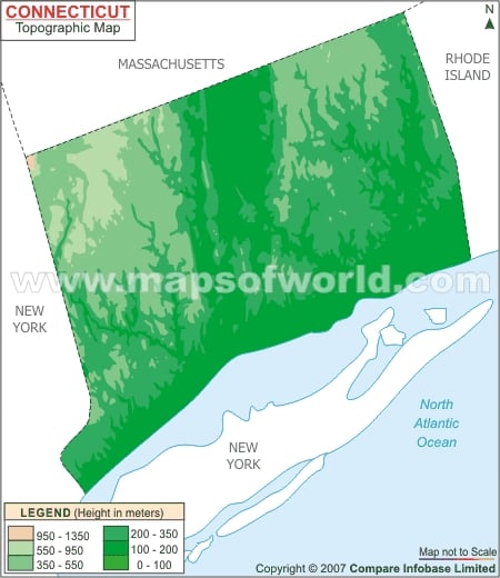
In its east is Rhode Island. Bear Mountain, located in Salisbury is the tallest peak in the state. The mountain is at the northwestern region of the state.
Mount Frissell’s southern slope is the tallest location in the northeastern states. This is the meeting point of Connecticut, New York and Massachusetts.
Connecticut River
The Connecticut River flows into Long Island Sound and passes through the center of the state. The metropolitan region with the maximum population in Connecticut is situated in Connecticut River Valley.
Connecticut Landscape
The landscape of this New England state is a varied one in spite of its comparatively small dimensions. The Litchfield Hills, located in the northwestern part, is filled with horse farms and rolling mountains. New London County, on the other hand, is located in the southeastern part and is a hub of maritime operations and has several beaches.
Connecticut has garnered some reputation on the basis of its maritime history but it does not have straight access to any sea. The state is comfortably close to the Atlantic Ocean but does not have an ocean coast of its own.
Connecticut Forests
Connecticut has both mixed and temperate broadleaf forests. The coastal forests in the state’s northeastern region comprise oaks, maple and hickories – these also cover a majority of the state. The New England-Acadian forests are located in the northwestern part of the state.
