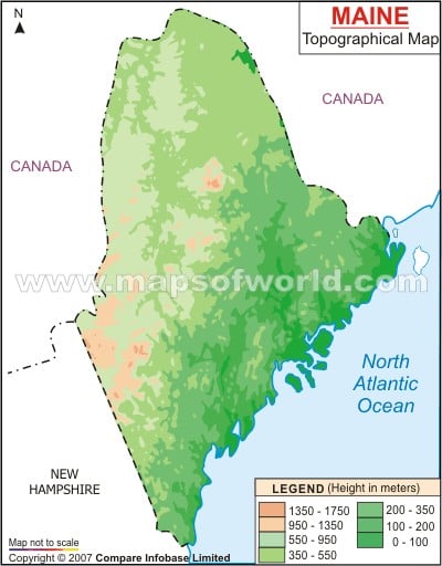
The mountains of Maine are an integral part of its topography. The Longfellow Range with nine peaks is located on the western front of the state of Maine. The 5267 ft Mount Katahdin, a part of the Longfellow range, is known to be the highest summit of Maine state. The coastal lowlands of Maine are 16 km to 32 km long. The upland zones of Maine state include flat plateau. The potato growing zone of Aroostook is one of the prime uplands of the state of Maine. Piedmont which is the transitional belt of hills, can be found from southwestern front of Maine to the northeastern part. On the southwestern side the piedmont is 48 km wide while it is 129 km long in the northeast front of Maine. St. John is the largest river of the Maine state. Sebago and Moosehead are the two major lakes of Maine. The Maine state map is also an important indicator of the topographic characteristics of the place.
Maine Topographic Map
Maine Topographic Map indicates the entire physiography of the state. Being categorized into uplands, coastal lowlands, mountains and piedmont, Maine state is intersected by around 5000 streams and rivers. Saco, Penobscot, Kennebec and Androscoggin are the main rivers of Maine.
1.3K
previous post
