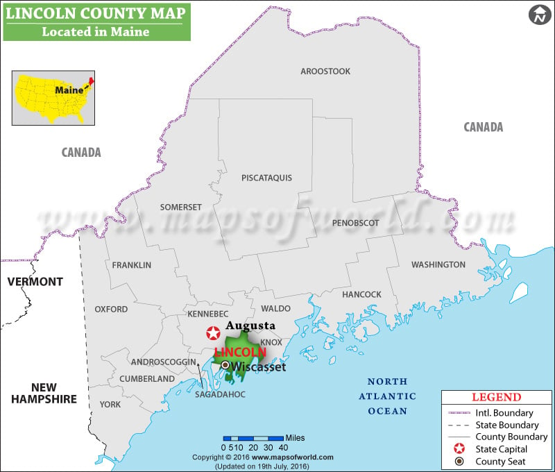
Facts about Lincoln County
| County | Lincoln |
| State | Maine |
| Country | USA |
| Population – 2015 | 33,969 |
Lincoln County is a county located in eastern Washington. It is the fifth least populous county in the state. Davenport is the county seat and the largest city. Harrington and Sprague are other cities with significant population. The county was established on November 24, 1883 and is named for the 16th US President Abraham Lincoln. The county covers a total area of 2,339 square miles. Agriculture, primarily wheat farming, is the mainstay of the county’s economy. Interstate 90, US Route 2, and US Route 395 are major roads connecting the towns in Washington. The Columbia River the largest river in the Pacific Northwest – defines most of the northern boundary of Lincoln County. The Grand Coulee Dam on the Columbia is located near the northwestern corner of the county.
MOW.DT.12.9.16
List of Counties in Maine
| County Name | County Seat/Capital | State | 2010 pop. | Area-km | Area-mi |
|---|---|---|---|---|---|
| Androscoggin | Auburn | Maine | 1,07,702 | 1,212 | 468 |
| Aroostook | Houlton | Maine | 71,870 | 17,279 | 6,671 |
| Cumberland | Portland | Maine | 2,81,674 | 2,163 | 835 |
| Franklin | Farmington | Maine | 30,768 | 4,394 | 1,697 |
| Hancock | Ellsworth | Maine | 54,418 | 4,110 | 1,587 |
| Kennebec | Augusta | Maine | 1,22,151 | 2,247 | 868 |
| Knox | Rockland | Maine | 39,736 | 946 | 365 |
| Lincoln | Wiscasset | Maine | 34,457 | 1,181 | 456 |
| Oxford | South Paris | Maine | 57,833 | 5,379 | 2,077 |
| Penobscot | Bangor | Maine | 1,53,923 | 8,799 | 3,397 |
| Piscataquis | Dover-Foxcroft | Maine | 17,535 | 10,259 | 3,961 |
| Sagadahoc | Bath | Maine | 35,293 | 657 | 254 |
| Somerset | Skowhegan | Maine | 52,228 | 10,164 | 3,924 |
| Waldo | Belfast | Maine | 38,786 | 1,890 | 730 |
| Washington | Machias | Maine | 32,856 | 6,637 | 2,563 |
| York | Alfred | Maine | 1,97,131 | 2,566 | 991 |
