- Kansas Counties - Kansas County Map, Map of Kansas Counties
- Major Cities of Kansas - Wichita, Lawrence
- Neighbouring States - Nebraska, Missouri, Oklahoma, Colorado
- Regional Maps - Map of USA
- Other Kansas Maps - Kansas Map, Where is Kansas, Kansas Airports Map, Kansas Lat Long Map, Kansas Zip Code Map, Kansas Area Code Map, Kansas National Parks Map,
Physical features of Kansas
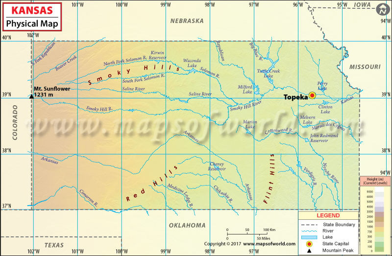
Kansas is located in Midwestern United States. The western two thirds part of Kansas, which is located in the great central plain, is characterized by flat or undulating surface. Hills and forests comprise the eastern part of the state. Mt. Sunflower, with a height of 4,039 feet, is the state’s highest point. The lowest point of the state lies along the banks of the Verdigris River. Some prominent rivers in the state include Kansas, Missouri, Saline, Republican, Smoky Hill, and the Arkansas. Apart from Mt Sunflower, other mountains located in the state are Rock Hill, Horsethief Draw, Salt Grass Canyon, Clough Valley, and Stateline Pasture to name a few. The state shares its borders with Nebraska, Missouri, Oklahoma, and Colorado.
Get more information about the physical features of state by referring to this informative map of Kansas. Listed on the map are the important river, systems, mountains, lakes and other such features. The map is useful for students, teachers, geographers and researchers.
MOW.PB.14.12.2016
 Wall Maps