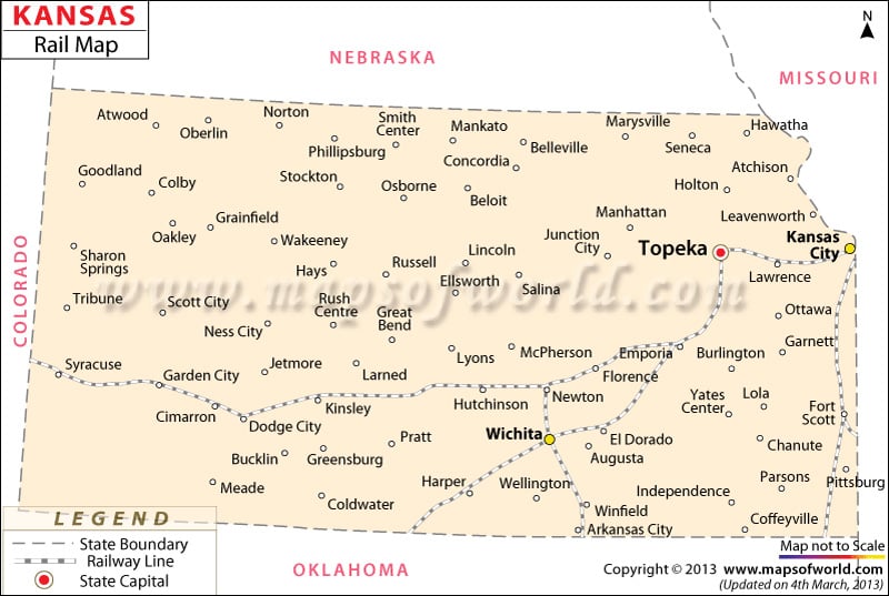
Rail Routes in Kansas
The Kansas Rail Map provides detailed information on the several rail routes of the state.
The State of Kansas is easily accessible by well laid railway tracks of the place. The Kansas Department of Transportation has divided the railroad services of the state into four categories of Class I Railroads, Class III Railroads, Passenger Railroads and Tourists Railroads .
Norfolk Southern, BNSF Railway, Union Pacific and Kansas City Southern rail routes fall under the category of Class I Railroad.
Amtrak is the Passenger Railroad of the State of Kansas. Cimarron Valley Railway, Kansas and Oklahoma, Blackwell Northern Gateway Railroad, Garden City Western and Kyle Railroad are some of the prominent rail routes Class III category. The Tourists Railroads include Midland Railway and Abilene and Smoky Valley. The rail routes of the state of Kansas connects the prominent cities of Kansas City, Lawrence, Ottawa, Topeka, Newton, Wichita, Wellington, El Dorado, Augusta, Jetmore, Pittsburg, Hutchinson, Garden City and Kinsley.
The Federal Railroad Administration of Kansas has introduced the Federal Rail Safety Accountability and Improvement Act to ensure safety and security of railway services. The Kansas State Map points out the important cities that offer railway services to the local inhabitants of the state.
 Wall Maps