
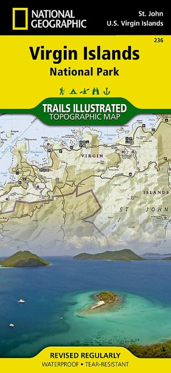
The Virgin Islands lie in the Lesser Antilles, 1,100 miles southeast of Miami. Several of the islands are British possessions, while others are part of the United States Virgin Islands National Park. This protected area encompasses about 7,200 acres of St. John, a hilly island with a history as fascinating as its scenery is lovely. Humans are believed to have reached the Virgin Islands about 3,000 years ago. Archaeological finds indicate that there were settlements on St. John several centuries before Columbus arrived in the Caribbean in 1492. Denmark claimed St. John and other islands in the 17th century, and beginning in 1718 Danes established plantations of sugarcane over most of the island. Land was cleared and the fields and sugar mills were worked by enslaved Africans, who were emancipated in 1848.
Buy for $14.95
Ruins from the plantation era, among St. John’s most evocative attractions, serve as reminders of the colonial period of wealth for a few plantation owners and slavery for hundreds of workers. After the plantations dwindled, St. Johnians, as locals are called, lived by raising cattle and cultivating crops.
The United States bought St. John and several other Virgin Islands from Denmark in 1917, basically for military purposes, and by the 1930s some U.S. citizens had begun to settle and vacation here. Among those enthralled by St. John was financier and conservationist Laurance S. Rockefeller, who bought more than 5,000 acres of land and donated it to serve as the foundation of a national park.
Snorkeling and scuba diving are highly popular in the park, which includes 5,650 acres of Caribbean Sea adjacent to St. John, as well as many small islands. To protect the marine environment, Virgin Islands Coral Reef National Monument was established in 2001. It encompasses nearly 20 square miles adjoining the national park and is administered by the staff of Virgin Islands National Park.
Today, vacationers from around the world come to enjoy the beaches, marine life, culture, shopping, and cuisine of the Virgin Islands. St. John, though, has neither airport nor cruise dock. Combined with the fact that most of its area lies within a national park, St. John offers a less crowded, more relaxed atmosphere than do its neighbors.
How to Visit
The great majority of visitors to St. John (those without their own boats) arrive by plane or ship at the nearby island of St. Thomas and take a short ferry ride over. They disembark at Cruz Bay, on the western end of the island. Because St. John is so compact, it’s possible to get a taste of scenery and history in a day by signing up for a tour that takes in one or more of the north shore beaches and the Annaberg Sugar Mill ruins.
With more time, consider hiking the Lind Point Trail or the strenuous Reef Bay Trail. Rent snorkel gear and get into the water at Trunk Bay or one of the many other island beaches. (The park offers a brochure that lists top snorkeling spots.)
Rental cars are available on St. John, but be aware that roads are narrow, steep, and extremely winding, and vehicles drive on the left-hand side of the road. Hiring a local driver is often the best bet.
Hotels are scarce on St. John; many visitors rent vacation homes for a week or more, or stay on St. Thomas and take the ferry. No passport is needed to visit the U.S. Virgin Islands, but you must have one to visit nearby British Virgin Islands such as Tortola and Jost Van Dyke.
Information
How to get there
Flights to St. Thomas are available out of several American cities. Regular ferries travel from St. Thomas to Cruz Bay, on St. John.
When to go
The weather is pleasant year-round. Nov. and Dec. are the rainiest months, and Feb. through April is the driest time of year. Hurricanes are of course unpredictable, but usually occur Aug. through Nov.
Visitor Centers
The park visitor center in Cruz Bay is open year-round.
Headquarters
1300 Cruz Bay Creek St. John, VI 00830 nps.gov/viis 340-776-6201
Camping
The campground at Cinnamon Bay (126 sites), which also offers cabins, is under renovation. For updated information: cinnamonbayresort.com; 340-714-7144.
Lodging
Hotel rooms are quite limited on St. John; many visitors rent houses by the week or longer. Luxury resort accommodations can be found at the Westin St. John Resort Villas (marriott.com; 340-693-8000). Arrange lodging as far in advance as possible during the peak season, Dec. through April. For lodging information: visitusvi.com.
US National Parks Map
About the Guide
