

- Nearby National Parks - Canyonlands National Park, Capitol Reef National Park
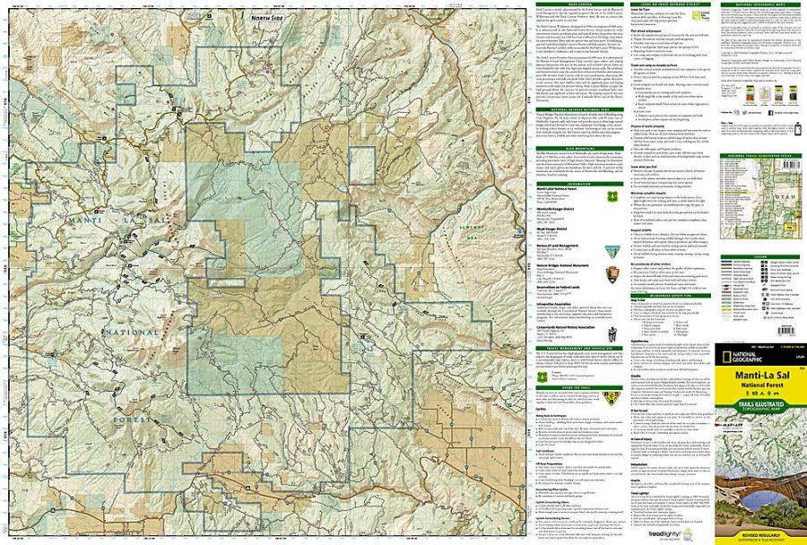
Manti-La Sal National Forest encompasses more than 1.2 million acres (5143 km2) and is headquartered in Price, with ranger district offices in Ferron, Price, Ephraim, Monticello and Moab. The Manti-la Sal National Forest is managed for multiple uses such as timber, range minerals, wildlife, water and recreation. The national forest area has three primary land areas, the La Sal Division at Moab, the Manti Division and La Sal Division at Monticello.
Where is Manti-La Sal National Forest
Manti-La Sal National Forest is located in the southeastern and central parts of Utah state and the extreme western part of Colorado in the United States.
Places to Visit Near Manti-La Sal National Forest
- Bears Ears National Monument
- Oowah Lake
- Dark Canyon Wilderness Area
- Miller Flat-Joes Valley-Huntington Canyon Recreation Area
- Sanpete North Recreation Area
- Sanpete South Recreation Area
- Spanish Fork-Scofield Recreation Area
- Two-Mile Recreation Area
- Sanpitch Recreation Area
Things to Do in Manti-La Sal National Forest
The tourists visiting Manti-La Sal National Forest can indulge in various activities and are very popular for recreation. The Forest Area has an extensive ATV Trail System. The Wasatch Plateau in the northern district is well known for Skyline Drive. The Moab district has several hiking trails in the La Sal Mountains, as well as it has views of the desert regions of Arches National Park and Canyonlands National Park. The Monticello District is home to the only wilderness area (Dark Canyon Wilderness) of Manti-La Sal National Forest. Some of the popular activities are:
- Mountain Climbing
- Fishing and Hunting
- Off-highway vehicle riding
- Hiking and biking
- Boating
- Scenic Drives and Ranger Programs
- Winter sports
- Horse riding and camping (Porcupine Rim)
- Sunset at Warner Lake
Manti-La Sal National Forest Hiking Trails
- Arapeen Off-Highway Vehicle Trail
- Aspen Flat/shay Ridge Trailhead
- Blue Creek-Allen Canyon Trail
- Skyline Trail
- Shay Mountain Trail
- Shay Ridge Trail
- Tuerto to Skyline Trail
- Wagonwheel Trail
- Camp Jackson Trail
- Hop Creek Trail
- Black Dragon Trail
- Big Bear Creek Trail
- Dairy Trail
- Dry Wash Trail
- Gateway Recreation Area
- Fisher Mesa Trail
- Kokopelli Trail
- Sinbad Ridge Trail
- Roc Creek Trail
- Elk Ridge Recreation Area
- Arch Canyon Trail
- Butts Canyon Trail
- Brushy Knoll Trail
- Chimney Park/Horse Flat Trail
- Vega Creek Trail
- Texas Trail
- West Rim Texas Canyon Trail
- Reservoir Canyon Trail
- Big Bear CreekTrail
- Dark Canyon West Trail
- Dark Canyon East Trail
- Peavine Canyon Trail
- Horse Canyon Trail
- Wooden shoe Trail
- Dark Canyon Wilderness Trail
- Chute Group Campground
- Old Folks Flat Group Campground
Facts About Manti-La Sal National Forest
- The Manti-La Sal National Forest parts are included in the Bears Ears National Monument.
- Manti-La Sal National Forest was established initially on May 29, 1903, as the Manti Forest Reserve. Nabo National Forest was added on July 1, 1915. On August 28, 1950, it was named Manti-La Sal National Forest.
- Only 2.1% of Manti-La Sal National Forest lies in Colorado in Montrose and Mesa counties. The forest land is located in San Juan, Sanpete county, Emery County, Utah County, Grand County, Carbon County and Sevier County, Utah.
- After Unitas, the La Sal Mountains are the second-highest mountain range in Utah. Mount Peale has the maximum elevation in the La Sal Mountains, reaching about 12,721 feet (3,877 m) above sea level.
Best Time to Visit Manti-La Sal National Forest
The Manti-La Sal National forest area is open year-round, with four seasons. The summers are dry and hot; Autumn is colourful, snowy and cold, and Spring season is rainy and chilly. The best time to visit the Manti-La Sal National fall season is between September and mid-October to see the foliage colour at its peak. The forest area has cooled down after the scorching summer, crowds are down, and foliage is jawdropping.
Visiting Hours Of Manti-La Sal National Forest
The Manti-La Sal National Forest is open year-round, 24 hours a day except on national holidays, and one does not need a pass to enter the Manti-la Sal National Forest.
Manti-La Sal National Forest Ticket Prices
The forest office does sell the Pass to enter state and national parks.
- Volunteer Pass (Free)
- Access Pass (Free)
- Annual Pass ($80)
- Senior Pass ($20)
- Senior Lifetime Pass ($80)
US National Parks Map