
Glen Canyon National Recreation Area, commonly known as Glen Canyon NRA, is a Conservation unit of United of the United States National Park Service. Glen Canyon NRA shares boundaries on the north with Canyonlands National Park and Capitol Reef National Park, West with Grand Staircase-Escalante National Monument, and the southeast with Navajo Nation.
Where is Glen Canyon National Recreation Area
The national recreation area encompasses the region around Lake Powell and lower Cataract Canyon in Utah and Arizona, covering 1,254,429 acres (5,076.49 km2) of mainly rugged desert terrain.
Places to Visit
- Vermillion Cliffs National Monument
- Grand Staircase-Escalante National Monument
- Glen Canyon Institute
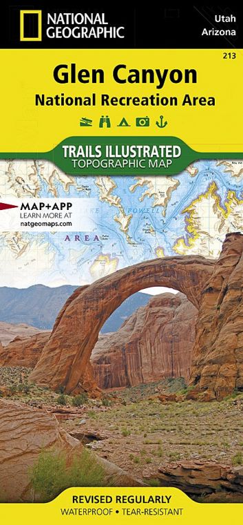
- Rainbow Bridge National Monument
- Paria Canyon-Vermilion Cliffs Wilderness
- Muley Point
- Orange Cliffs
Buy for $14.95
Things to Do
The tourist visiting Glen Canyon National Recreation Area can indulge in various activities. With nearly 2,000 miles (3,200 km) of fish-holding shoreline at Lake Powell, the region provides opportunities to fish for largemouth bass, striped bass, and smallmouth bass in the waters of the recreation area. The Glen Canyon National Recreation Area region has been developed to access Lake Powel via five marinas, two small airports, four public campgrounds, two small airports, and numerous houseboat rental concessions.
Some of the popular activities are:
- Water Skiing
- Fishing (trout, Smallmouth bass, largemouth bass and Striped bass)
- Hiking and biking
- Boating, Rafting, Canoeing, Kayaking, Parasailing and Paddling
- Camping (extended Rock Beach Primitive Camping Area, Stanton Creek Primitive, Beehives Campground, Wahweap Campground and RV Park, Lake Powell Shoreline Primitive Camping)
- Scenic Drives and Ranger Programs
Hiking
There are numerous trails available in Glen Canyon Recreation Area for Hiking and Biking inside the park. Some of the famous trails of the national recreation area are:
-
Horseshoe Bend:
It is one of the most popular hiking trails as Horseshoe Canyon is one of the most prominent features at Glen Canyon National Recreation Area. The trail leads to an overlook viewing platform. The trail has a round-trip Distance of 1.5 mi(2.4 km).
-
Glen Canyon Rim Trail:
It is a 12 miles (9.3 km) long trail that offers views of Unique geological formations, the Vermillion Cliffs and the Colorado River. The trail is sometimes rough and Rocky and sometimes Sandy.
-
Dam Overlook:
The Trail is only 940 ft (286 m long). The trail follows the steep, uneven rocky steps to Glen Canyon Dam and the Colorado River views.
-
Hanging Gardens:
The Trail is 1.5 mi (2.4 km long), hidden by Jurassic Navajo; seep springs take every drop of rainwater it can absorb, creating a lush plant and animal habitat.
- Other trails are Beehive Trail, Chains, Stude Horse Trail, and Wiregrass Canyon and the biking trails are Warm Creek Road, Crosby Canyon Road, Alstrom Point Road and Grand Bench Road Wahweap Area. The Bullfrog/Escalante region has Burr Trail, Purple Hills and Hole-in-the-Rock Road. The Orange Cliffs Area has Flint Trail, North Hatch Canyon, Panorama Point/Cleopatra’s Chair, Land’s End/Big Ridge, Brown’s Rim, Blue Notch and Elaterite Basin.
Facts about Glen Canyon National Recreation Area
- The national recreation area is named after Glen Canyon, which the Glen Canyon Dam flooded in 1966, and is now mostly submerged under the waters of Lake Powell.
- In 1972 Glen Canyon NRA was established for recreation (public use) and to preserve the area’s scientific, scenic and historical features.
- Glen Canyon NRA encompasses more than 1.25 million acres in southeastern Utah and northern Arizona.
- Glen Canyon NRA includes portions of Coconino County in Arizona and Kane, Garfield, Wayne and San Juan counties in Utah.
Visiting Hours
The Glen Canyon National Recreation Area is vast, and the weather varies from location to location. The summer months are for the visitors of Lake Powell due to fantastic opportunities for the boaters and other recreation opportunities for the vacationers. The weather is hot in the summers and going to Lake Powell is a great way to beat the heat. The crowd is less in winters as the temperature dips, and one can experience other areas other than lake Powell. The visitor’s centres of the Glen Canyon NRA have different timings through different seasons.
-
Carl Hayden Visitor Center:
The summer timings are 8 AM-6 PM daily, and the Winter Season timings are 8 AM-4 PM.
-
Glen Canyon Conservancy Flagship:
The Flagship Visitor Center is open daily 9:00 AM-5:PM
-
Bullfrog Visitor Center:
This Visitor Center is open daily from 9:00 AM -4; PM Thursday through Monday in the summer. It is closed in winter from September 27-April 17.
Tickets Prices
Weekly Passes
- Entrance Fee Individual (A person entering by foot or bicycle): $15:00 (youth 15 and under are free)
- Entrance Fee Private Vehicle: $30.00
- Entrance Fee Motorcycle: $25.00
- Boating Entrance: $30.00
- Boating Entrance additional vessel: $30.00
Annual passes
- Glen Canyon National Recreation Area Annual Pass-$55
- Glen Can National Recreation Area Annual Vessel Sticker: $50
- Annual Senior Pass:$20
- Annual Military Pass: Free*
- Lifetime Senior Pass: $80
- Lifetime Access Pass: Free
- Annual Volunteer Pass: Free (250 hours of volunteer service)
US National Parks Map