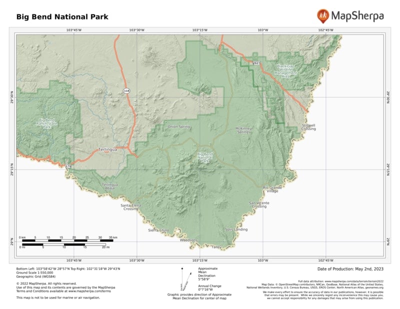
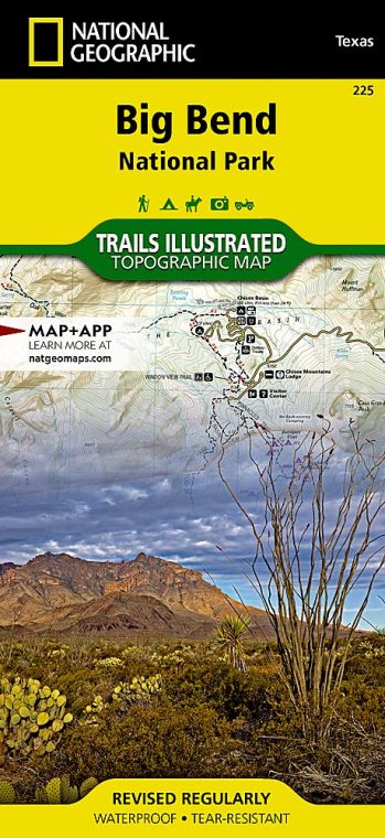
Encompassing more than 1,200 square miles of western Texas, the park is located where the Rio Grande makes a “big bend” southward and back north again. The river forms the U.S.–Mexican border for 118 miles. Along the way it flows through some of the most spectacular canyons in North America.
Most of Big Bend is Chihuahuan Desert, a ruggedly beautiful terrain that offers a glorious display of blooming wildflowers when sufficient rain falls. In the center of the park rise the Chisos Mountains, volcanic highlands crowned by 7,825-foot Emory Peak.
It’s this juxtaposition of environments—river, desert, and mountains —that gives Big Bend its broad diversity of plants and animals. Cottonwoods and willows border the Rio Grande; barrel cactus, ocotillo, and creosote bush grow in the Chihuahuan Desert; and woodlands of pine and oak cover the slopes of the Chisos. The wildlife ranges from beaver in the riparian corridor to mule deer and javelina in the foothills to black bear in the mountains. More species of birds, bats, reptiles, butterflies, scorpions, ants, and cacti have been documented here than in any other national park.
Geologists revere Big Bend as a showcase of Earth’s tumultuous past. You can see sandstone rocks 500 million years old; an outlying segment of the Rocky Mountains dating back around 100 million years; the Chisos Mountains, created by volcanic eruptions about 35 million years ago; and the Rio Grande, which took its present course less than two million years ago. Paleontologists studying the area’s ancient past have discovered a fascinating and scientifically important array of fossilized dinosaurs and other animals. studying the area’s ancient past have discovered a fascinating and scientifically important array of fossilized dinosaurs and other animals.
Big Bend National Park has been designated a UNESCO Biosphere Reserve; a stretch of the Rio Grande is a National Wild and Scenic River. These honors provide official recognition of the park’s unspoiled wilderness and biodiversity.
How to Visit
It’s one thing to learn that Big Bend is a huge park. It’s another thing to realize that it takes around two hours to drive from Rio Grande Village to “nearby” Santa Elena Canyon. Given its size and scope, you could easily spend a week here.
Stop at the Panther Junction Visitor Center, 28 miles south of the park’s north entrance, to see an orientation video, study the 3-D model of the park, get maps and advice, and walk the short nature trail. If time allows, head north to near the end of Grapevine Hills Road and hike the mostly flat Grapevine Hills Trail (2.2 miles round-trip), to where Balanced Rock frames expansive views
Next, drive to the Chisos Basin and admire the peaks of the Chisos Mountains. Then take the Ross Maxwell Scenic Drive to see the chasm of Santa Elena Canyon.
If you have more time, go birdwatching at Rio Grande Village and soak in the nearby hot spring. If you are equipped with the proper gear and plenty of water, walk a trail— perhaps the 3.8-mile round-trip Mule Ears Spring Trail in the desert or the 1.8-mile Chisos Basin Loop Trail in the mountains.
For a wilderness river adventure, which can run from two days up to 10 or more, check with local outfitters about a canoe or raft trip on the Rio Grande.
If you’re flying to the area and renting a car, consider getting a high-clearance vehicle. This will open up opportunities to travel some of the park’s primitive roads to see true backcountry and visit sites such as old villages and abandoned mines. Gasoline is available in the park and at Study Butte on its western border, but it’s a long way between stations. Make sure your vehicle is in good condition, and check your fuel gauge often.
Useful Information
How to get there
From Dallas, TX (about 550 miles northeast), take I-20 west to Monahans, then go south on Tex. 18 and U.S. 385. From El Paso, TX (about 300 miles northwest), take I-10 east to Van Horn and then U.S. 90 east to U.S. 385.
When to go
Temperatures are most pleasant from fall through spring. Summer is very hot, although cooler in the Chisos Mountains. Campgrounds and lodgings fill up quickly for Thanksgiving week, around Christmas, and during spring break.
Visitor Centers
Visitor centers at Panther Junction and Chisos Basin are open year-round. The Persimmon Gap visitor center is open most of the year; Castolon and Rio Grande Village are open Nov. through April.
Headquarters
P.O. Box 129 Big Bend National Park, TX 79834 nps.gov/bibe 432-477-2251
Camping
Sites at two of the three developed campgrounds—Chisos Basin (60 sites), and Rio Grande Village (100 sites)— can be reserved mid-Nov.–mid-April (recreation.gov; 877-444-6777). Cottonwood Campground (24 sites), does not take reservations. All require a permit (fee). For backcountry camping (fee), permits must be obtained in person at the Panther Junction Visitor Center.
Lodging
In Chisos Basin, the Chisos Mountains Lodge is a concessioner-operated facility (chisosmountainslodge.com; 877-386-4383). Hotels are located in Study Butte, Terlingua, and Lajitas. For more information: Brewster County Tourism Council (visitbigbend.com).
US National Parks Map
About the Guide


