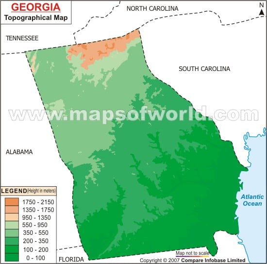
Situated at an altitude of 4,784 feet above the sea level, the Brasstown Bald which is the highest point of Georgia lies in the northern mountainous region of the state. The Piedmont Plateau occupies the central part of the state. The lowland area of Kolkhida is situated in the western part of Georgia.
The fertile coastal plain lies in the southern region of Georgia. The Eastern Continental Divide has divided the state into two geographic divisions of eastern and western Georgia. While eastern Georgia comes under the watershed region of the Atlantic Ocean, western Georgia falls under the watershed area of the Gulf of Mexico. River Chattahoochee, River Savannah and River Suwannee are the major rivers of Georgia. River Ocmulgee and River Oconee flow through the central part of the state.
Georgia has many natural and man made lakes. Lake Sidney Lanier, West Point Lake, Lake Hartwell and Clark Hill Lake are some of the notable lakes of Georgia. The Georgia State Map indicates the heterogeneous topography of the state.
