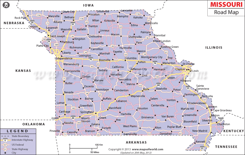
With over 123,039 miles of public roads, Missouri is well connected by an extensive network of roads and thoroughfares, and its five interstates run the span of the state: North/South via Interstate 35, Interstate 55 and Interstate 29, and then East/West via Interstate 70 and Interstate 44.
For instance, the I-70 interstate highway connects St. Louis with Kansas City, I-55 connects St. Louis with Chicago, I-44 joins St. Louis with Joplin and Springfield while I-35 connects Des Moines with Kansas City. According to a 2006 DMV report, as many as 4,640,569 vehicles were registered under the Motor Vehicles Act of the state (specifically: 1,851,429 trucks, 2,715,215 passenger cars and 12,985 public buses).
The first road of Missouri State was constructed during the early part of the 1700s to connect Ste. Genevieve with the nearby lead mines. The Missouri Transport Department, along with building new and maintaining old roads, marks the state’s byways with different coded colors for motorists to highlight curves and bends.
 Wall Maps