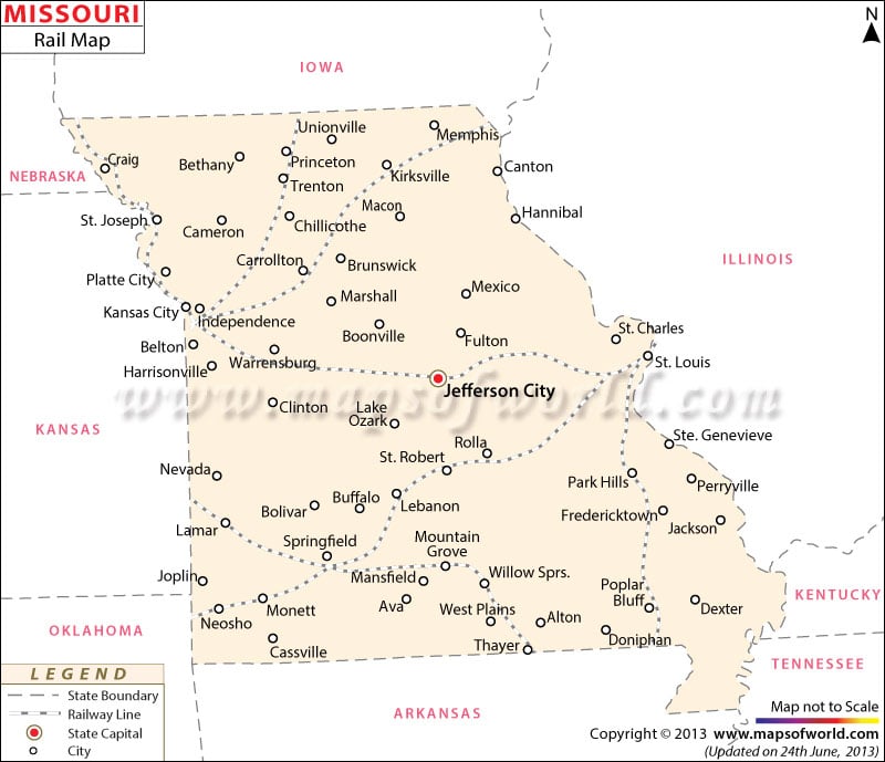
Missouri Railway Map shows the wide network of railroads that connect the many towns and cities of the state. As one of the major railroad organizations in Missouri, Amtrak offers service to Kansas City, Chicago and St. Louis, and, apart from the eight trains plying from Chicago to St. Louis to Kansas City, also offers two daily trains from Kansas City to St. Louis. According to official report, in 2000, Missouri possessed a total of 4,540 miles of railway, and Class I tracks stood at 3,621.
In 1851, the full-scale construction of railroads in Missouri began, and in the year 1865, the Union Pacific Railroad extended up near Kansas City. The St. Joseph and Hannibal Railroads facilitated the connection to Kansas City via a bridge in 1869. By opting for a train travel, newcomers to the state can get a fair idea of Missouri’s railway history, and may find a complete overview of the state’s extensive track routes provided in the Missouri railway map.
 Wall Maps