Rivers in Pennsylvania
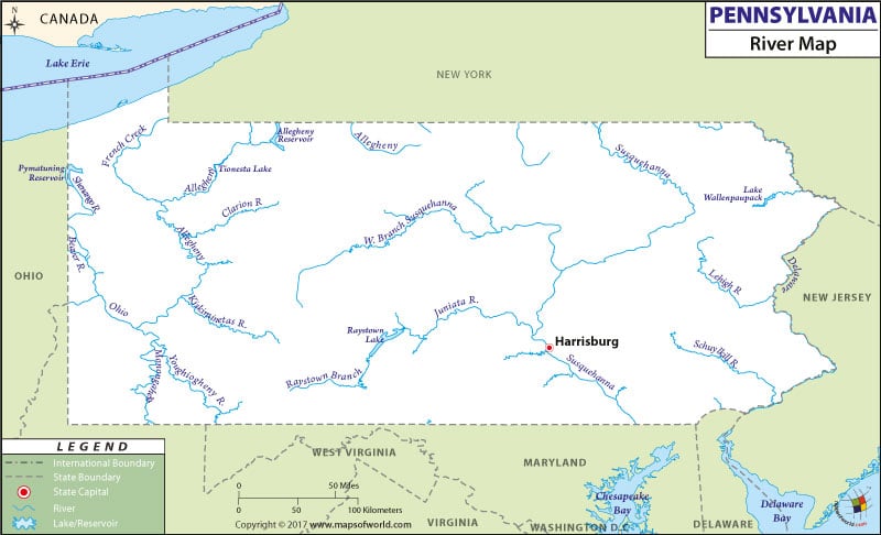
The several rivers and streams flowing across the state are prominently marked in the Pennsylvania River Map. Susquehanna River, Ohio River, Allegheny River and Delaware River are some of the important rivers of Pennsylvania.
The drainage system of Pennsylvania is divided by the St. Lawrence Seaway Divide and the Eastern Continental Divide. The central and eastern regions of Pennsylvania fall under the watershed drainage area of the Atlantic Ocean. The Delaware River and the Susquehanna River flow through the eastern and central part of the state. The Susquehanna River drains into the Chesapeake Bay and the Delaware River drains into the Delaware Bay.
Some parts of the counties of Potter and Erie come under the watershed drainage area of St. Lawrence. The Mississippi River Watershed drains the rest of the State of Pennsylvania. The Monongahela and Allegheny Rivers flow through the western region of Pennsylvania and drain into the Ohio River at Pittsburg. Some of the other notable rivers of the western part of Pennsylvania are the Clarion River, Youghiogheny River, and the Beaver River.
The Pennsylvania State Map marks the 250 natural and artificial lakes of the state. Lake Conneaut is the biggest natural lake of Pennsylvania. Lake Erie is another important lake of the state.
 Wall Maps