
|

| Description: Find Mozambique latitude and longitude map showing comprehensive details including cities, roads, towns, airports and much more. | Disclaimer |
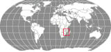
The main latitude and longitude of Mozambique is 18° 15'South and 35° East. The total area which falls within the first and last latitude and longitude of Mozambique is 801,590 square kilometer.
The country of Mozambique falls in between Equator and the Tropic of Capricorn. The close proximity of latitudes of Mozambique to the Tropic of Capricorn is responsible for the sub-tropical type of climate in most part of the country. The weather of whole of Mozambique is different because of the mountainous terrains and the coastal areas so though in the tropical zone it lacks all its features.
The latitude and longitude of the capital of Mozambique , Maputo, is 25° 57'South and 32° 35'East. The Mozambique longitude falls to the east of the Prime Meridian so the time zone of the country runs two hours ahead of the Greenwich Mean Time. There is a difference of seven hours from the standard time of Washington DC.
The latitude and longitude of the capital of Mozambique , Maputo, is 25° 57'South and 32° 35'East. The Mozambique longitude falls to the east of the Prime Meridian so the time zone of the country runs two hours ahead of the Greenwich Mean Time. There is a difference of seven hours from the standard time of Washington DC.
-
Locations Latitude Longitude Alto Ligonha 15°30'S 38°11'E Alto Molocue 15°50'S 37°35'E Angoche 16°08'S 39°55'E Angoche, I., 16°20'S 39°50'E Bandula 19°00'S 33°07'E Barra Falsa, Pta. Da 22°58'S 35°37'E Bartolomeu Dias 21°10'S 35°08'E Bazaruto, I. Do 21°40'S 35°28'E Beira 19°50'S 34°52'E Bela Vista 26°10'S 32°44'E Benga 16°11'S 33°40'E Benguerua, I. 21°58'S 35°28'E Bilibiza 12°30'S 40°20'E Boane 26°06'S 32°19'E Buzi 19°50'S 34°43'E Cabora Bassa Dam/Cahora Bassa, Represa de 15°20'S 32°50'E Cahora Bassa, L. de 15°35'S 32°00'E Cahora Bassa, Represa de 15°20'S 32°50'E Caia 17°51'S 35°24'E Capoche 15°35'S 33°00'E Catembe 26°00'S 32°33'E Catuane 26°48'S 32°18'E Catur 13°45'S 35°30'E Cauresi 17°08'S 33°00'E Changane 24°30'S 33°30'E Chapala 15°50'S 37°35'E Charre 17°13'S 35°10'E Chemba 17°09'S 34°53'E Chibabava 20°17'S 33°35'E Chibuto 24°40'S 33°33'E Chicomo 24°31'S 34°06'E Chicualacuala 22°06'S 31°42'E Chidenguele 24°55'S 34°11'E Chiducane 24°35'S 34°25'E Chiloane, I. 20°40'S 34°55'E Chimoio 19°04'S 33°30'E Chinde 18°35'S 36°30'E Chinga 15°13'S 38°35'E Chingune 20°33'S 34°58'E Chinhanguanine 25°21'S 32°30'E Chiramba 16°55'S 34°39'E Chonguene 25°03'S 33°49'E Chumuare 14°31'S 31°50'E Coalane 17°48'S 37°02'E Cobue 12°00'S 34°58'E Cochemane 17°00'S 32°54'E Conceicao 18°47'S 36°07'E Contra Costa 25°09'S 33°30'E Correntes, C.das 24°06'S 35°34'E Crocodile/Krokodil 25°14'S 32°18'E Cuacua 17°54'S 37°00'E Cuamba 14°45'S 36°22'E Delgado, C. 10°45'S 40°40'E Don Ana/Nhamaabue 17°25'S 35°05'E Dondo 19°33'S 34°46'E Elefantes 24°10'S 32°40'E Espungabera 20°29'S 32°45'E Fingoe 14°55'S 31°50'E Funhalouro 23°03'S 66°00'W Gaza 23°10'S 32°45'E Goba 26°15'S 32°13'E Gondola 19°10'S 33°37'E Goonda 19°48'S 33°57'E Gorongose 20°30'S 34°40'E Gorongoza 18°44'S 34°02'E Gorongoza, Sa. Da 18°27'S 34°02'E Guija 24°27'S 33°00'E Guro 17°26'S 32°30'E Gurue 15°25'S 36°58'E Homoine 23°55'S 35°08'E Ibo 12°22'S 40°40'E Incomati 25°46'S 32°43'E Inhaca 26°01'S 32°57'E Inhafenga 20°36'S 33°53'E Inhambane 23°54'S 35°30'E Inhambane 22°30'S 34°20'E Inhaminga 18°26'S 35°00'E Inharrime 24°30'S 35°00'E Inharrime 24°30'S 35°00'E Jangamo 24°06'S 35°21'E Jofane 21°15'S 34°18'E Krokodil 25°14'S 32°18'E Lacerdonia 18°03'S 35°35'E Larde 16°28'S 39°43'E Lichinga 13°13'S 35°11'E Licking 17°40'S 37°15'E Ligonha 16°54'S 39°09'E Lipali 15°50'S 35°50'E Lucheringo 11°43'S 36°17'E Lugela 16°25'S 36°43'E Lugenda 11°25'S 38°33'E Lupilichi 11°47'S 35°13'E Maave 21°04'S 34°47'E Mabalane 23°37'S 32°31'E Machanga 20°59'S 35°0'E Machava 25°54'S 32°28'E Machece 19°15'S 35°32'E Macia 25°2'S 33°08'E Macodoene 23°32'S 35°05'E Macossa 17°55'S 33°56'E Macovane 21°30'S 35°02'E Macubela 16°53'S 37°49'E Macuiza 18°07'S 34°29'E Macuse 17°45'S 37°10'E Magude 25°02'S 32°40'E
-
Locations Latitude Longitude Malei 17°12'S 36°58'E Malema 14°57'S 37°20'E MandiMba 14°20'S 35°40'E Manhica 25°23'S 32°49'W Manica 18°58'S 32°59'E Manica 19°10'S 33°45'E Manjacaze 24°45'S 34°0'E Mapinhane 22°20'S 35°0'W Mapulangune 24°29'S 32°06'E Maputo 25°58'S 32°32'E Maputo B. de 25°50'S 32°45'E Marao 24°18'S 34°02'E Marracuence 25°45'S 32°35'E Marrubane 18°0'S 37°0'E Marrupa 13°08'S 37°3 Massangena 21°34'S 33°0'E Massinga 23°15'S 35°22'E Massingir 23°51'S 32°04'E Matibane 14°49'S 40°45'E Matuba 24°28'S 32°49'E Maxixe 23°54'S 35°17'E Mazoe 16°42'S 33°07'E Mazoe 16°20'S 33°30'E Mecanhelas 15°12'S 35°54'E Meconta 14°59'S 39°50'E Memba 14°11'S 40°30'E Mepaco 15°57'S 30°48'E Messalo 12°25'S 39°15'E Metangula 12°40'S 34°50'E Metengobalame 14°49'S 34°30'E Metil 16°24'S 39°0'E Milange 16°03'S 35°45'E Miramer 23°50'N 35°35'E Moamba 25°36'S 32°15'E Mocambique 15°03'S 40°42'E Mocimboa da Praia 11°25'S 40°20'E Mocuba 16°54'S 36°57'E Moebase 17°03'S 38°41'E Mogincual 15°35'S 40°25'E Moma 16°47'S 39°04'E Monapo 14°56'S 40°19'E Montepuez 13°08'S 38°59'E Montepuez 12°32'S 40°27'E Mopeia Velha 17°30'S 35°40'W Morrumbene 23°31'S 35°16'E Mossuril 14°58'S 40°42'E Motaze 24°48'S 32°52'E Mozambique/Mocambique 15°03'S 40°42'E Muecate 14°55'S 39°40'E Mueda 11°36'S 39°28'E Muende 14°28'S 33°0'E Mungari 17°12'S 33°30'E Mutanda 21°0'S 33°34'E Mutuali 14°55'S 37°0'E Mwenezi 22°40'S 31°50'E Nacala 14°31'S 40°34'E Nacala-Velha 14°32'S 40°34'E Nacaroa 14°22'S 39°56'E Nalazi 24°03'S 33°20'E Namacurra 17°30'S 36°50'E Namapa 13°43'S 39°50'E Nameponda 15°50'S 39°50'E Nametil 15°40'S 39°21'E Nampula 15°06'S 39°15'E Nangade 11°05'S 39°36'E Nanripe 13°52'S 38°52'E Nhacoongo 24°18'S 35°14'E Nhamaabue 17°25'S 35°05'E Nhangulaze L. 24°0'S 34°30'E Niassa 13°30'S 36°0'E Nova Lusitania 19°50'S 34°34'E Nova Mambone 21°0'S 35°03'E Nova Sofala 20°07'S 34°42'E Nungo 13°23'S 37°43'E Pafuri 22°28'S 31°17'E Palma 10°46'S 40°29'E Panda 24°02'S 34°45'E Pebane 17°10'S 38°08'E Pemba 12°58'S 40°30'E Pomene 22°53'S 35°33'E Ponte do Pungue 19°30'S 34°33'E Pungue Ponte de 19°0'S 34°0'E Quelimane 17°53'S 36°58'E Quilua 16°17'S 39°54'W Quinga 15°49'S 40°15'E Quissanga 12°24'S 40°28'E Quissico 24°42'S 34°44'E Quixaxe 15°17'S 40°04'E Ressano Garcia 25°25'S 32°0'E Revue 19°50'S 34°0'E Ribaue 14°57'S 38°17'E Sanga 12°22'S 35°21'E Savane 19°37'S 35°8'E Save 21°16'S 34°0'E Sena 17°25'S 35°0'E Sofala 19°30'S 34°30'E Sone 17°23'S 34°55'E Songo 15°34'S 32°38'E Tete 16°13'S 33°33'E Ulongue 14°37'S 34°19'E Vila da Maganja 17°18'S 37°30'E Vila Gamito 14°12'S 33°0'E Vila Vasco Da Gama 14°54'S 32°14'E Vilanculos 22°1'S 35°17'E Vunduzi 18°56'S 34°1'E


"By clicking OK or by using this Website, you consent to the use of cookies. Your personal data will be governed by Mapsofworld Privacy Policy and Terms."
Get customize mapping solution including
For further info please get in touch with us at
 [email protected]

Copyright © 2024 mapsofworld.com. All Rights Reserved