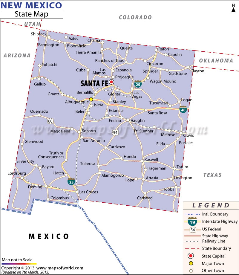
Also known as “Land of Enchantment”, the state of New Mexico lies in the southeastern United States. The state is famous for expansive deserts, rugged flat-topped hills, the hit AMC series Breaking Bad, and cultural heritage with strong Hispanic and Native American influences.
Santa Fe is the state capital while Albuquerque is the largest city in the state. Farmington, Roswell, and Rio Rancho are other cities in New Mexico worth visiting.
Tourist Attractions in New Mexico
- Carlsbad Caverns National Park
- White Sands National Monument
- Bandelier National Monument
- Albuquerque Biological Park
- Chaco Culture National Historical Park
- National Museum of Nuclear Science & History
- Sandia Peak Tramway
- Valle Vidal
Getting In and Around
Albuquerque International Sunport (ABQ) is the busiest airport in New Mexico.
Amtrak’s Southwest Chief, Texas Eagle, and Sunset Limited serve the state.
Interstate Highways I-10, I-25, and I-40 along with U.S. Highways form a dense road network.
 Wall Maps