- Maine Counties - Maine County Map, Map of Main Counties
- Major Cities of Maine - Augusta, Bangor
- Neighbouring States - New Hampshire
- Regional Maps - Map of USA
- Other Maine Maps - Maine Map, Where is Maine, Maine Airports Map, Maine Lat Long Map, Maine Zip Code Map, Maine Area Code Map, Maine National Parks Map
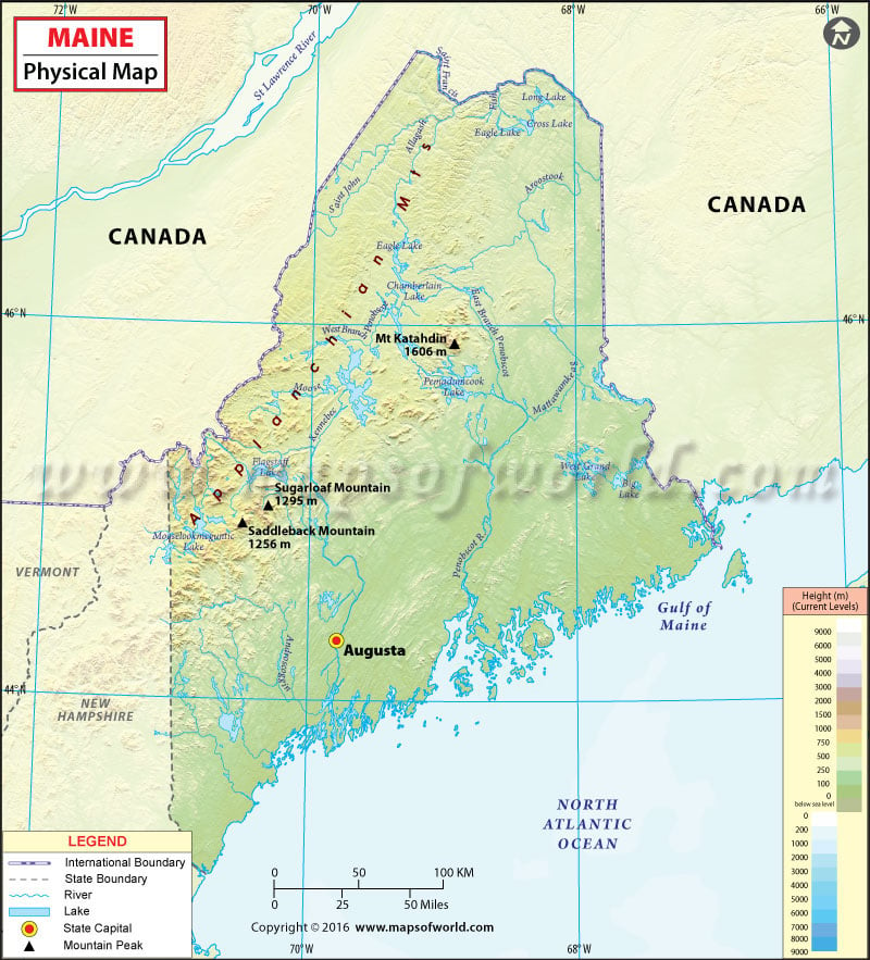
The state of Maine comprises three distinct natural landforms: the Atlantic Ocean Coastal Lowlands, the Central Uplands, and the Appalachian Mountains.
The sub-ranges of the Appalachians span the northwestern reaches of the state. The scattered Longfellow Mountains is a major range in Maine. These mountains are considered an extension of White Mountains reaching in from the state of New Hampshire. Mount Katahdin, the centerpiece of Baxter State Park, is the highest point in Maine at 1,605 meters (5,267 feet). Moreover, High Peaks region contains eight of the 14 mountains which are above 4,000 feet in height. Western Maine Mountains spans western border with the state of New Hampshire.
The North Maine Woods region comprises more than 3.5 million acres of wooded land. In the north-central region of Maine deep freshwater lakes of the last Ice Age cover the land with endless canopy of pine forests. Due to this, Maine has earned its nickname “The Pine Tree State.” The coastal area features the mixed oaks of the Northeastern coastal forests. Moving inland, the North Woods is covered by the New England-Acadian forests.
The state has about 230 miles (400 km) of coastline along the East Coast of the United States. The jagged and rockbound Atlantic coastline is a mixture of inlets, bays, sandy beaches, and thousands of craggy islands. With a surface area of 75,451 acres, Moosehead Lake is the largest mountain lake in the eastern US. Located in the Maine Highlands, it is the source of the Kennebec River. Other major rivers in Maine include the Androscoggin, Penobscot, St. Croix, and St. John.
MOW.DT.12.16.16
 Wall Maps