- Indiana Counties - Indiana County Map, Map of Indiana Counties
- Major Cities of Indiana - Indianapolis, South Bend, Fort Wayne
- Neighbouring States - Michigan, Ohio, Illinois, Kentucky
- Regional Maps - Map of USA
- Other Indiana Maps - Indiana Map, Where is Indiana, Indiana Airports Map, Indiana Lat Long Map, Indiana Zip Code Map, Indiana Area Code Map, Indiana National Parks Map
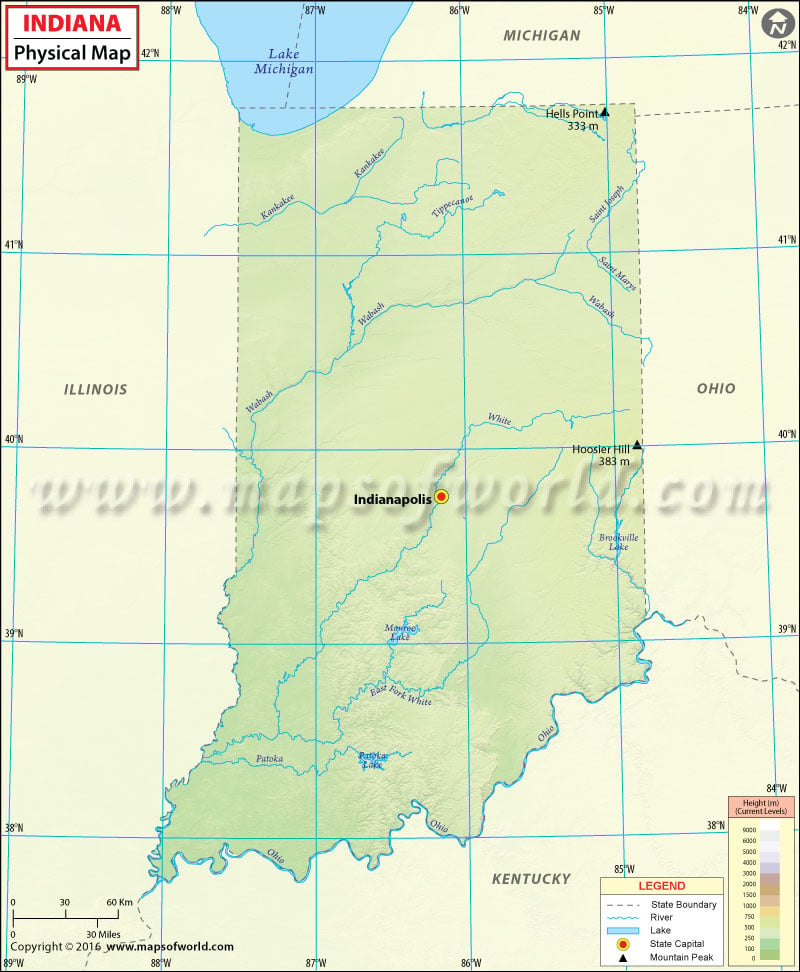
Physical Map of Indiana
The state of Indiana is situated in the Midwestern region of the United States. Indiana shares its borders with Michigan, Ohio and Illinois. Lake Michigan is located to the northwest of India while Kentucky is separated from the state by Ohio River.
The Central Lowlands and the Interior Low Plateaus are the two natural regions of the US that form a part of the state. The Till Plains stretch over the central and northern allotment of Indiana. The southern third of Indiana is much more hilly as compared to other parts of the state. This part of the state comprises the foothills of the Cumberland Plateau. Northern Indiana is characterized by higher and hillier terminal moraines. Many sand ridges and dunes comprise the northwest part of the state. The southern part of Indiana is very different from the other regions of the state. This area is characterized by rolling fields, forests, and sharp hills.
With a height of 1,257 feet, Hoosier Hill is the highest point in the state. Other prominent mountains are Hells Point, Sand Hill, Weed Patch Hill, Diamond Hill and Paradise Point to name a few. Some rivers that run through the state include Wabash River, Ohio River, Kankakee River, Maumee River, Iroquois River etc.
 Wall Maps