South Bend City Facts |
|---|
| Country | USA (United States of America) |
|---|---|
| State | Indiana |
| County | Saint Joeseph County |
| Total Area | 39.1 sq miles |
| Lat Long Coordinates | 41.6833° N, 86.2500° W |
| Time Zone | EST (UTC−05:00) |
| Area Code | 574 |
| Language | English |
| Major Religion | Roman Catholic, Christian |
| Museums | Studebaker National Museum, The Snite Museum of Art |
| University | University of Notre Dame |
| Official Website | www.ci.south-bend.in.us |
Tourist attractions:
Airports:
|
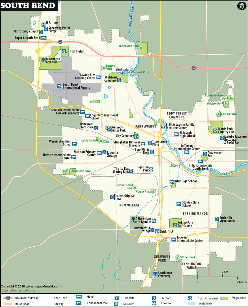
South Bend is a city in the U.S state of Indiana. Earlier in 1831, the city was laid out as the county seat of St. Joseph County. Established in 1835, the city grew into a manufacturing city with a number of businesses. It is now the fourth largest city in Indiana. It has developed much to become the economic and cultural hub of Michiana.
Hotels:
The city has a number of hotels that offer all facilities like conference halls, meeting rooms, clubs etc aimed at business people visiting the city. People can also avail the facilities like swimming pools, Internet and telephone. Inn at Saint Mary’s Hotel & Suites, Residence Inn South Bend, Quality Inn University, Hampton Inn and Suites , South Bend Marriott, Jamison Inn, Americas Best Value Inn and Suites, Comfort Suites, Quality Inn & Suites, Holiday Inn Express South Bend / Notre Dame, Super 8 Motel , Signature Inn , Holiday Inn South Bend-City Center and Motel 6 are the famous hotels in the city.
Transportation:
South Bend Regional Airport is the main gateway to the city. The electric commuter railroad connects the city with other regions. A bus line links the city with other areas. The highways, expressways and other well-built roads help in easy transportation.
Places to Visit:
South Bend has many museums such as South Bend Regional Museum of Art, National Register of Historic Places, Studebaker National Museum that has a large collection of wagons and automobiles, The Museums at Washington and Chapin that preserve the historical artifacts of the city. Copshaholm Mansion and Gardens, Potawatomi Zoo-the oldest zoo in Indiana, Morris Performing Arts Center, South Bend Conservatory, University of Notre Dame, Northern Indiana Center for History and South Bend Parks and Recreation Department are the highlights of the city.
Schools:
Parks:
|
POI:
Hospital:
|
 Wall Maps