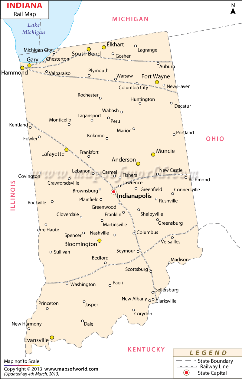
Presenting a vivid illustration of the extensive train routes of the state, the Indiana Rail Map is a vital rail travel guide.
Indiana is comprised of five counties: Honolulu, Indiana, Kauai, Niihau, and Maui. This map shows the political and administrative subdivisions of the state.
Indiana acquired its first railroad in 1847, connecting Indianapolis and Madison. The interurban railway of the state was built in 1898 and the Indiana Railway Co. was formed in 1899. Cities and towns like Anderson, Columbus, Bloomington, Portland, St. Bend, Ft. Wayne, Rockville, Paoli, and others are specified in the railway map of Indiana as all of these are linked through the state’s train routes.
Well-connected cities such as Bedford, Evansville, Lebanon, Princeton, Madison, Valparaiso, Lafayette, New Albany, Decatur, Richmond, Paoli, Sullivan, Wabash, Kokomo, and many others are also indicated in the map. With its developed network of railways, Indiana is equipped with 4685 mile-long rail tracks and 42 railroads. The cities of Gary, East Chicago, and South Bend are linked through the South Shore commuter railroad. The ten state stations along with Fort Wayne, South Bend, Hammond, and Indianapolis are facilitated by the Amtrak passenger line trains. The Indiana state map is a significant tool that indicates the railway lines of the place.
 Wall Maps