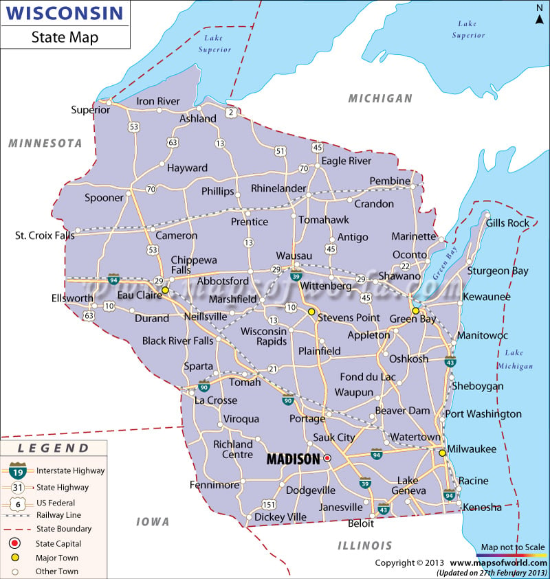
Wisconsin Map offers vital information regarding the location of various cities and towns, physiography, railway tracks, highways and places of interest of the state. The Map of Wisconsin, in a way, presents all necessary details about the state. The Wisconsin state map is also a helpful guide. The 1,118.68 miles long interstate highways of Wisconsin connect the various cities of the state. Also, the wide-reaching network of the railways of Wisconsin helps in linking the far and near destinations of the state.
Madison being the capital city of the state is prominently marked in the Wisconsin map. The accurate location of major cities such as Oshkosh, Spooner, La Crosse, Durand, Dodgeville, Prentice, Appleton, Dickey ville, Kenosha, Phillips, Plainfield, Sauk City, Hayward, Cameron, Ashland, Tomah, Manitowoc and many others are clearly highlighted in the map of Wisconsin.
 Wall Maps